 |
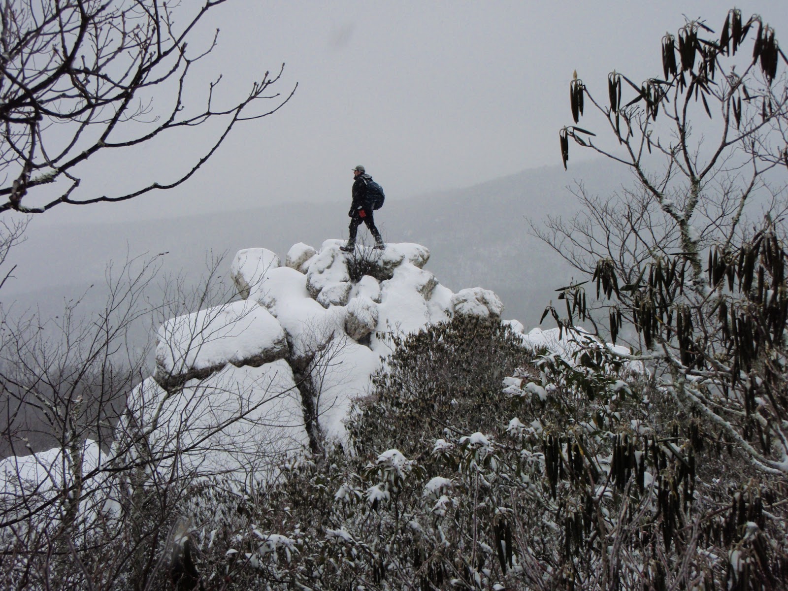
| Enjoying the good life on High Rocks. |
 |
| My backyard view of Chimney Rocks, High Rocks, and Sand Mountain. |
Sand Mountain rises to 3,721’ just south of the Wytheville town limits. It’s summit is conspicuous because of the large microwave tower on top, but on a sunny afternoon the brightly gleaming quartzite cliffs on the next, slightly lower, rise to the east draw the eye even more. That is High Rocks, probably the most dramatic spot and best hike in Wythe County. Then there is also an even lower outcropping of shining boulders that is well known locally as Chimney Rocks.
My very first visits to all three of these wonderful places were nearly 35 years ago, back when I was in my early teens, and were with my good friends Landon Miller and his dad Artie Miller, then with members of my Boy Scout troop. I spent a lot of time on various parts of Sand Mountain back in those days and it played a major role in cultivating my love of mountains. Mostly, this was when I was getting hooked on hunting, something I haven’t done in twenty years. But I remember always thinking it was a real adventure anytime I got to visit one of these high spots and their sweeping views. And they definitely made me appreciate clifftops and firetowers, and fanned a desire to visit more.
 |
| Sand Mountain firetower, now gone. |
 |
| The southern overlook on Sand Mountain. |
 |
| The northern overlook on Sand Mountain. Photo by Tommy Bell |
 |
| Rime and Wytheville from the northern overlook on Sand Mountain. |
Back on top, it is a fairly simple matter to follow a faint path along the crest of the mountain, connecting the paint splotches of the boundary line between Town of Wytheville and DGIF property for 3/10 of a mile east until you drop down into a saddle and rise slightly again to hit the High Rocks trail. Turn right and continue another 100 yards or so to the top.
But if that is your only goal, or if you wish to visit Chimney Rocks, it is easier to start at another trailhead, where Route 640 (Broadway Road) crosses the top of Sand Mountain at about the 3,140’ elevation. A good trail leads 1 ½ miles to High Rocks, most of it easy - although there are two short steep sections. Just past the top of the first steep section, and just shy of the 1 mile mark, the flat saddle between Point 3563 and High Rocks is the best jumping off point for a 6/10 mile long off-trail visit to Chimney Rocks. While there is a good trail up to Chimney Rocks from below, it starts on private property with no public access. It also basically ends at the rocks, though an intermittent faint path continues toward the High Rocks trail and the jumping off point above. Be forewarned that it is easy to veer off course when going to Chimney Rocks from above. The ridge is broad and the route goes north partway before veering northwest. If you don’t do this to stay on the direct ridgeline, you will miss the rocks completely and continue dropping off the mountain. Map and compass skills would be helpful, and a gps makes it easy. Chimney Rocks is more of a big boulder pile than a cliff, and it is possible to do a little scrambling around here while also taking in the great views which are quite similar to those from Buzzard Rocks, though a bit less expansive because of being some 300’ lower.
 |
| +Leanne scrambling up Chimney Rocks. |
But High Rocks still awaits. From the one mile mark on the trail, continue another three or four tenths of a mile on a flat terrace bordered by much Catawba rhododendron, mountain laurel, and both pink and flame azaleas. At the right time, in late May and early June, this is a colorful display of pink, purple, white, and orange floral beauty, as is the entire trail. If you look carefully, you just might spot one or two pink ladyslippers as well. The trail leads directly beneath High Rocks near its end, then does a U-turn into the gap between High Rocks and Sand Mountain before making one final steep climb up the back side of the rocks. It’s an easy walk-up onto the top of the rocks and one of the nicest spots around this little part of the world, with grandstand views and gnarled pines. It’s also a long way down to the ground off the precipitous north side!
By moving around a bit, it is possible to see an open arc of almost 270° from these gleaming quartzite cliffs. The wildest scene is looking southwest, ignoring the nearby towers on Sand Mountain. With the exception of a couple of distant powerline towers and a small farm or two, there is no sign of civilization, not even a road. There is only forest and mountains in sight, culminating in the 5,729’ top of Virginia on Mount Rogers, flanked by its companions of Wilburn Ridge and Whitetop. Even more so than here, that high country is probably my favorite place in Virginia and maybe even the entire Southeast. There is something appealing about being able to see one favorite and special place from another.
 |
| Rhododendron in bloom along the trail. |
But there are other special places in sight too, like Chestnut Knob and Clinch Mountain. Wytheville is again laid out below in its valley, and Fort Chiswell is also in sight beyond the dramatic cliff face a couple dozen yards away. Much of the Iron Mountains are in sight, along with Point Lookout and Buck Mountains. So are Big Walker Mountain, Cove Mountain, Draper Mountain, even Bald Knob which is the massif that holds The Cascades and Mountain Lake some 45 miles away. Chimney Rocks is visible 300’ lower and ½ mile due north. Much of the mountain land immediately around is protected and publicly accessible as part of either the 7,500 acre Big Survey Wildlife Management Area (access permit needed) or the 1,800 acre Crystal Springs Recreation Area owned by the Town of Wytheville. I’ve been to this spot well over 100 times and I never get tired of it. I’ve been here on perfect Spring and Fall days, I’ve been here on hot, muggy days to enjoy the breeze, I’ve been here on bitter cold days with a foot of snow when you can see who knows how far, I’ve been here in the clouds when you couldn’t even see 100 yards but when the trees were coated with rime, I’ve walked up here just to clear my mind and think, I’ve watched glorious sunrises and sunsets from here, I’ve been here with friends and loved ones many times and I’ve been here alone many more times. And I intend to be here many more times in the future.
 |
| Mount Rogers at sunset from High Rocks. |
 |
| High Rocks |
.JPG) |
| Tommy Bell and me on High Rocks. Photo by Jeff Simmons |
 |
| +Peter Barr on High Rocks. |
SAM SLEMP
1954 - 2003
FRIEND TO MAN, DOG AND MOTHER NATURE
Every time I see the bench I am reminded that I still miss him.
How this whole area was protected for all to enjoy is worth a brief mention. When the State of Virginia acquired it in 2001, it was one of the larger remaining tracts of relatively pristine, family-owned land in the state. It had been pretty heavily posted for years prior to that and had no real public access. Much of it had been leased by the Matney Flats Hunting Club and I had access to it through membership, but when the club went defunct so did my access for several years. I was pretty excited about it when it became known that an opportunity for Virginia to purchase it as a wildlife management area had arisen. There is an article about it by the Western Virginia Land Trust here. I am forever grateful that everything worked out due to the hard work of the many individuals involved and parties involved. Now it is available for all to enjoy, even though I rarely see anyone there.
Another note on Sam that I just found out about - while many were involved in protecting the Big Survey, he was one of the first people to help. Local environmental activist Liza Field heard that a timber agent was discussing deals with the Shaeffer family about logging and developing the property. Sam had just fixed Liza’s camera and she told him that she needed to get photos quickly, to assemble a slide show to take to the Western Virginia Land Trust director, Virginia Outdoors Foundation, and others. He said "Oh, I've always loved the Big Survey. Can I go?" In Liza’s words “Sam took entire slide trays of excellent photos. It was his photos that blew away Rupert Cutler, the land trust director who let me show him the slides in his basement. From there, we sent his photos to Natural Heritage division of DCR. Every critical juncture involved in getting help (and you would not believe how many sources needed to be convinced to help, when all the local authorities said it could not be done and was too "ambitious") involved Sam Slemp's photos.” Thanks Sam!
Trails and routes to Sand Mountain, High Rocks, and Chimney Rocks. To view a larger map click here.
Hike Stats:
Sand Mountain via Towers Road - 4 miles round trip, 1,250' elevation gain
Sand Mountain via Rocky Road Trail - 5 miles round trip, 1,300' elevation gain
High Rocks from Sand Mountain - add 8/10 mile round trip, 320' cumulative elevation gain
High Rocks via High Rocks Trail - 3 miles round trip, 600' cumulative elevation gain
Chimney Rocks from High Rocks Trail - add 1.2 miles round trip, 240' cumulative elevation gain
Pictures from hikes to Sand Mountain, High Rocks, and Chimney Rocks:
January 2013 - Sand Mountain and High Rocks (rime)
December 2012 - Sand Mountain
August 2012 - Sand Mountain at sunset
June 2012 - High Rocks (sunset)
May 2012 - High Rocks (flowers)
November 2011 - High Rocks (sunset)
October 2011 - High Rocks
May 2011 - Sand Mountain (above the clouds)
May 2011 - High Rocks and Sand Mountain (flowers)
October 2010 - High Rocks (sunset)
May 2010 - Sand Mountain and High Rocks
January 2010 - Sand Mountain
August 2009 - High Rocks and Chimney Rocks
May 2009 - High Rocks
May 2009 - Chimney Rocks (flowers)
April 2009 - Sand Mountain
March 2009 - Sand Mountain (above the clouds)
March 2009 - Sand Mountain (rime)
January 2009 - Sand Mountain
December 2008 - High Rocks and Chimney Rock
August 2008 - High Rocks (sunset)
June 2008 - High Rocks
June 2007 - High Rocks (flowers)
Scanned pics from before 2007 (sunsets, flowers, firetower)
Resources and Contacts:
DGIF Access Permit Info
DGIF Big Survey WMA page
DGIF Virginia Birding and Wildlife Trail page
Town of Wytheville Crystal Springs Recreation Area page
My SummitPost page for these hikes
Happy Trails High Rocks article by Sam Slemp
Happy Trails Sand Mountain article by Sam Slemp
Western Virginia Land Trust article about Big Survey protection
gpx and kml files, topo maps
View Larger Map
Trailhead coordinates:
Towers Road 36.91555,-81.08809
Crystal Springs/Rocky Road Trail 36.89995,-81.09311
High Rocks Trail 36.90643,-81.04243
Google map for trailheads
Scan QR code to navigate to trailheads with Google Maps on your smartphone:

Dear Rickey,
ReplyDeleteI've hiked to the top of nearly every peak on Massanutten Mountain except for Morgan Knob and Lairds Knob. While I was looking for information on Lairds Knob, I cam across your pictures on Picasa, and it didn't take long for me to find your blog.
The summit of Lairds Knob is on private property, and I know that some people have hiked up the road to the radio tower and went from there to the summit. It's also possible to approach the summit from another direction. I've hiked up to Grubbs Knob, which has a faint trail that goes beyond its summit in the direction of Lairds Knob. How did you get there? Who would I contact to get permission if necessary?
Sorry to hear about the loss of your friend.
Tom Yager
Hi Tom,
ReplyDeleteI accidentally replied to the email I got about this comment - but it's a "no reply" address. How can I message you privately? Are you on Facebook? If so, send me a link to your profile and I'll send you a PM. Or you can find a link to mine on my Blogger profile.
Rick
Thanks, Rick.
ReplyDeletehttps://www.facebook.com/tom.yager.752
Got it! Check your Facebook inbox now.
ReplyDeleteRick