 |
| On October 5, 2013, Peter Barr and I became Adirondack 46ers atop the 4,150' summit of Sawteeth |
We had started planning our return for this year during the drive home last year. By the time +Peter Barr and his wife +Allison had finished their Summer visit to the Northeast a couple months earlier, he still needed eighteen peaks to my nine, but we had agreed that it might be possible for us to both finish on this year's trip. It was ambitious, and would require everything to go just right, but it was possible and sounded like a great idea to me. I had also gotten +David Socky interested in joining us, not because he was particularly interested in the 46ers, but because it promised to be a great trip with lots of good hikes. I was quite excited when the day of our departure finally arrived, especially when the 10 day forecast looked unbelievably good.
 |
| Halfway! Dave's 25th state highpoint. |
Hitting the road around 5 a.m., we drove pretty much nonstop except for gas, and made it to Port Jervis, NY early enough that I suggested we make a quick drive up to the nearby New Jersey state highpoint so that Dave could add it to his growing list of completions. Accurately, but unimaginatively named High Point, this 1,803’ foot mountain was Dave’s 25th state high point, and along with a scale replica of the Washington Monument on its summit, on a clear day it actually has surprisingly good views of the Kitattiny Ridge, Hudson Highlands, and Shawangunks, as well as the higher and more distant Catskills. We did not linger long, as we had hopes of doing a short hike in the Southern Adirondacks before dark. I had tried to fit Crane Mountain into other trips before, but it had never quite worked out. This time it did. We got to the trailhead with, as it turned out, just enough time to do a great four mile loop to the cliffy summit of this classic hike and start the trip off right. The rest of the week would be spent climbing Adirondack 46ers.
 |
| Peter on Crane Mountain. Photo by Dave Socky |
 |
| Dave crossing the Hudson River. |
We decided to start the remainder of the week off by "eating the frog first" and doing what would probably be two of the hardest hikes of the trip on the first two days. The pick for Day One ended up being Allen Mountain, a peak that doesn't have a reputation for being the most spectacular in the Dacks, but does have the distinction of being one of the most remote, as well as requiring possibly the longest hike to get a single peak, a near twenty miler. One can normally bag several Adirondack peaks on a hike of this length. It has the additional difficulties of two river crossings, several normally boggy areas, and the notoriously slick "red slime" on the wet rocks of the mountain proper. Much to our pleasure, we had a comparatively easy day, a theme that would be true all week thanks to dry weather. The crossings of both the Hudson and the Opalescent Rivers were relatively easy rockhops, and there was little in the way of mud and boggy areas. We did still have the algae slickened rocks and steepness of the actual climb of the peak to deal with though, so it wasn't a “gimme” by any means, and we still barely managed to finish by dark, therefore having no chance of also tacking on a side trip up Mount Adams. That firetower peak will have to wait for another time, but it had turned out that Allen had surprisingly good views of its own, particularly toward the Great Range. Sawteeth, the peak we hoped to finish the 46ers on later in the week was in plain sight too, which was pretty neat.
 |
| Sawteeth (right center) would be my and Peter's final ADK 46er peak at the end of the week. Our ascent route would follow the Scenic Trail across the "sawteeth" of the right ridgeline. |
 |
| I stepped in an Adirondack booby trap on the way back from Allen. |

The next morning we were on the trail shortly after it got light and soon enough we were heading up Santanoni Brook. Once we got onto the herd path at Bradley Pond, things were straight up as usual and we began the root grabbing, rock scrambling ascent to Times Square, thence to the summit of Panther Peak and its excellent views. Of course, there was also a perhaps too good view of the little bundle of joy that we were heading for next. That would be 3,792' Couchsachraga, "affectionately" known as "Cooch". Since this peak actually misses being a 4,000 Footer by over two hundred feet - and isn't even a ranked peak, I think most people are annoyed by the fact that it remains on the list. It would probably elicit less animosity if it were easy, but the simple fact of the matter is that it requires a side trip of three miles, losing and gaining several hundred feet of elevation, part of it steeply, and crossing a notorious bog in the col between it and Panther. Oh yeah - it doesn't even have a view. It turned out that the hike was actually kind of fun though, and the bog wasn't that big of an obstacle - no doubt thanks to the dry weather. A couple of older gentlemen we had passed just before the bog however, had told Dave that "I wouldn't want to be you" when they saw that he didn't have trekking poles to use for balance while crossing all the small limbs and branches that past hikers have laid out across the bog. This funny remark ended up being oft repeated the rest of the week whenever the going got really challenging, because the upper part of this"trail" is probably nearly as difficult as anything else I have ever done in the Adirondacks.
 |
| Eyeing the long side trip to 'Coochie. While we were NOT looking forward to doing that peak, it turned out to be less difficult than anticipated. |
 |
| Dave descending the extremely steep and aptly named upper section of the Santanoni Express. In a classic case of downplaying the difficulty, another hiker had very casually told us "it's not bad". |
 |
| The Sawtooth Mountains and the distant pyramid of Whiteface. Photo by Dave Socky |
Monday's hike was somewhat easier, a single peak trek up Seymour. This ended up being quite enjoyable, with several miles of easy walking on the relatively flat and smooth Ward Brook Truck Trail. There was also a nice display of Fall foliage all along this first part of the hike, with lots of reds and oranges. I would say that the colors were pretty much at peak here. The hike up the actual mountain was just a typical bout of going straight up, complete with occasional sections of Adirondack problem solving. Just before topping out, we got waylaid by a large outcropping just off the trail known as"See-more" Rock. The views from here were nothing less than spectacular. The summit would just have to wait because we decided to take a long lunch and picture break at this unexpectedly wonderful lookout with a sweeping view that included Seward, Ampersand, the Sawtooths, Whiteface, and a large swath of the North Country beyond. It was a few more minutes to the top, and as usual, there was still a bit more work to do than expected to get there. I had a prophetic fortune at the Chinese buffet in Saranac Lake afterwards. It said: "Your aspirations are met with success soon." I decided to keep that one.
 |
| Trail through the krumholz on Colden. Photo by Dave Socky |
 |
| On Bob's namesake peak - Mount Marshall. Photo by Dave Socky |
 |
| On the herd path for Cliff Mountain, another typical obstacle in the Dacks, where easy hiking is a rarity - but it's never boring! |
 |
| Even the valley trails are slow going at times. In Avalanche Pass. |
We had mistakenly assumed the second day of this hike would be relatively easy. It was not. We headed up the Opalescent River to the herd path for Redfield and Cliff, thence continued climbing along Uphill Brook. Actually, Redfield wasn't unusually difficult, it just seemed longer than I was expecting. This was our first viewless peak, as we found ourselves well up into the clouds this morning. At least it wasn't raining though. Cliff turned out to be appropriately named and was considerably more difficult than I was anticipating based on its modest length and elevation gain. A lot of that gain was rather precipitous and involved a good bit of challenging, but fun scrambling up rock faces. It was also a bit more of a drop into the col between the false and true summits than I expected from a cursory glance at the map. We were still in the clouds on this one too, so we did not linger. Where we did linger for a while was at the rather spectacular spot on the Opalescent River where a decent sized waterfall plunged into a narrow slot canyon-like defile. After returning to the leanto and gathering our gear, we began the hike back out as the skies cleared. This made for a great walk through the always amazing Avalanche Pass area and its rocky ruggedness.
 |
| On top of Basin Mountain. Haystack, Skylight, and Marcy in the distance. Photo by Peter Barr |
 |
| Slight exposure on Saddleback. |
 |
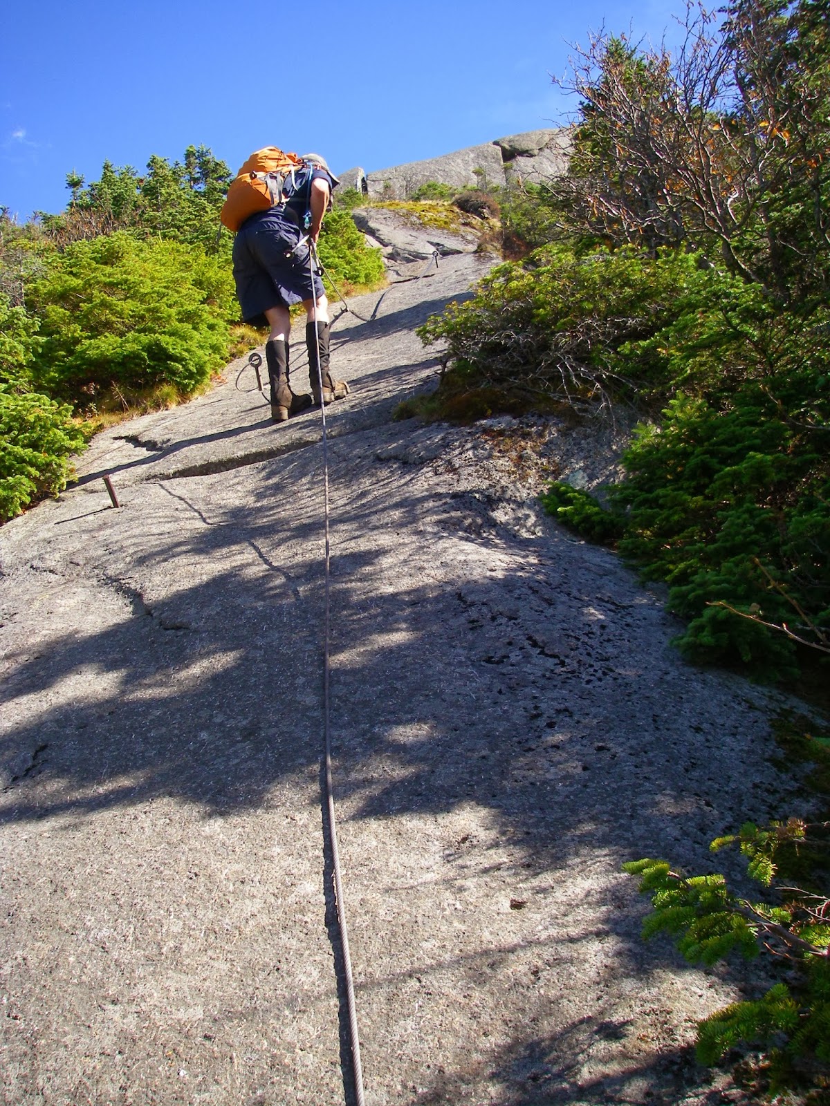
| The first time I climbed Gothics, this cable was a lifesaver because the rock was icy and I had neglected to bring traction devices on the trip. This time it was under perfect conditions! |
 |
| The massive hulk of Giant Mountain (left) and Rocky Peak Ridge. Vermont's Camels Hump is faintly visible between them. At center right is the rocky summit of Noonmark. |
 |
| The cliffs of Gothics. Photo by Dave Socky |
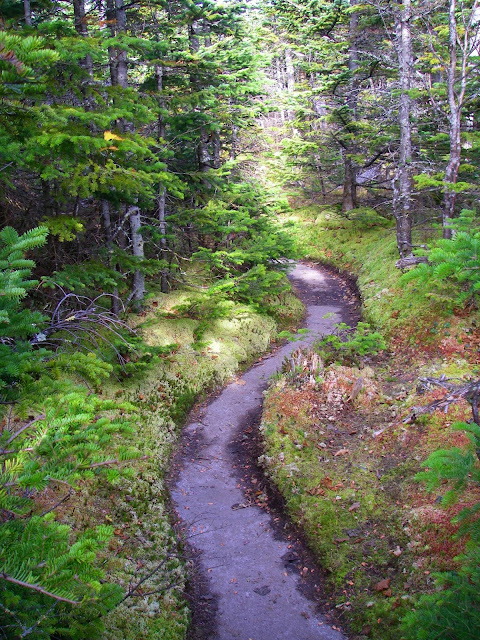 |
| The beckoning path. This may also be the easiest spot on the Range Trail! We enjoyed all 100 feet of its brevity... |
While tied with the hike up Allen at 19.4 miles as our longest, our toughest and most spectacular day by far was next, a traverse of most of the Great Range. We were on the trail by 5:30 a.m. for this six peak day with over 7,000 feet of total elevation gain. It was awesome to go up the new slide below the Gothics-Saddleback col - that wasn't there the first time I hiked that trail back in 1999. We did an out and back over Saddleback to Basin, and while definitely steep and certainly spectacular, neither peak was quite as vertical as I remembered. That was probably a good thing, as I had been at least a little apprehensive about going down the southwest side of Saddleback. Even so, one of us took a bit of a controlled fall at a particularly tricky spot. The real treat for me was the climb up Gothics. I did it with snow and ice, and no views the first time. Today was a bluebird day with perfect visibility. And with no ice, I was actually able to walk up the extremely steep but grippy slabs without really needing the cables. There were some burning calves though! We also made the short, but "interesting" and ever so worthwhile side trip to Pyramid. A lot of people think this is another contender for the best view in the Adirondacks. I can't say it is, but I also can't say it isn't. It is amazing by any standard. The remaining three peaks of Armstrong and the two Wolfjaws was somewhat easier than the first three peaks, but definitely still had their moments and were almost new to me, since it had been so long since I was last on them. I had hoped to go down the Bennie's Brook slide, but since we reached the top of Upper Wolfjaw just before sunset (a beautiful one at that), we decided it smart to descend on the trail instead to finish the last several miles in the dark. In fact, it was nearly 10 p.m. when we reached the car, and we had to settle for frozen pizzas bought at Stewart's and baked at the Keene Valley Hostel for dinner. The adventure of the day had been worth it though.
 |
| Great lunch spot - the summit of Rocky Peak Ridge. Photo by Dave Socky |
 |
| On Bald Peak. Photo by Dave Socky |
The Friday of this trip we had yet another spectacular hike planned. Though I had been on the two highest peaks once before, we had a shuttle set up so that we could do a one way traverse of Rocky Peak Ridge and Giant. A large portion of this hike is out in the open with continuous views, and many think it is one of the finest hikes in the range. We also made a new friend. I had asked about shuttle possibilities on the Adirondack High Peaks forum before the trip, and as a result, we were contacted by Kevin Sullivan, a fellow Dacks enthusiast. He was interested in joining us if we didn't mind. We didn't, and it was great hiking with him. I already have tentative plans to hike with him again around Christmas when I should be in the Catskills. Anyway, the hike was indeed great, though also somewhat mellow compared to the Great Range - at least to Rocky Peak Ridge. We had a lot of wonderful views from the open ridgeline up to that point, but by the time we made the steep descent to the col beyond and then climbed up to Giant, it had started raining lightly, and the views were much diminished, though not completely obliterated. The wet rock did make much of the descent a little tricky though. The peaks of the last two days had been repeats for me, but they had allowed Peter to catch up to me, and now we both stood at 45 peaks completed. Tomorrow, if all went as hoped, we would become Adirondack 46ers!
 |
| Yet another ladder... |
 |
| ...and another scramble... |
 |
| ...and another ladder... |
 |
| ...and another scramble... |
 |
| ...then the goal is near. |
 |
| Feeling good on the summit of Sawteeth, the final peak in our rewarding quest. Photo by Peter Barr |
 |
| Mission accomplished! Photo by Peter barr |
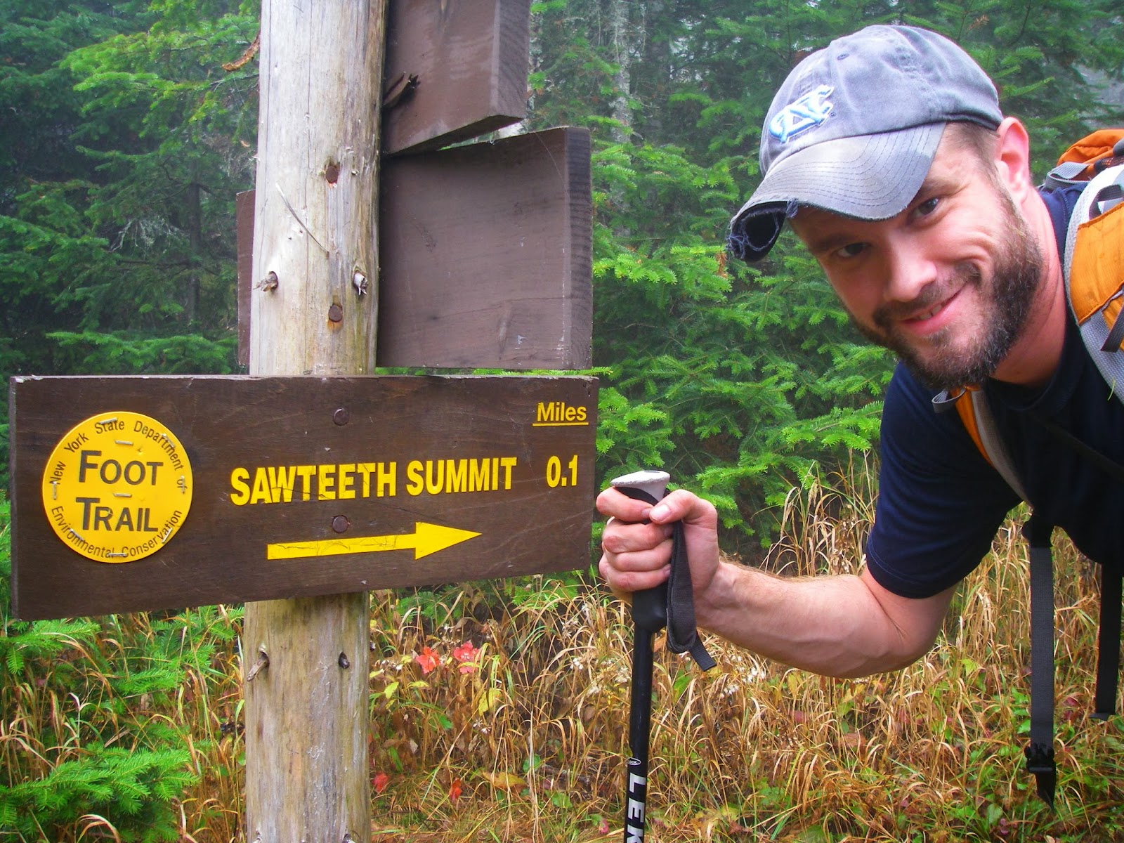
Our final peak for this long sought after quest started out with a road walk on the property of the Ausable Club. This gated gravel road actually makes for rather pleasant, fast hiking after a week of mostly rough footing and got us to the start of the loop over Sawteeth. It was another cloudy morning, but it wasn't raining so we were still excited about what we were about to do. Soon we were headed up the Scenic Trail and began encountering a series of viewpoints overlooking the fiord-like Lower Ausable Lake and the cloud-shrouded Colvin Range above it. We would have been disappointed if the going didn't get tough. We were not disappointed. The only disappointment was that we eventually walked up into the clouds. That alone could not quell our excitement when we got to the sign starting that the summit was only a tenth of a mile away. We did our best to all three step onto the summit rock at the same time, Peter and I at that moment becoming two more among the distinguished ranks of the 46ers and Dave having caught the bug.
It had been a sometimes hard, always challenging, mostly fun pursuit and the memories of it all will be with me for the rest of my life. But I am far from finished with exploring the Adirondacks and have every intention of returning many more times in the years to come. But first there are those two peaks I need in New Hampshire to complete the Northeast 115...
More pics from this trip:
Adirondacks 2012 (Day 8)
More pics of other trips to the Adirondacks:
Northeast 2004 (coming soon)
Northeast 2006 (coming soon)


This comment has been removed by a blog administrator.
ReplyDeleteI love seeing photos of the Daks! So different from any other eastern range!
ReplyDeleteThey are indeed pretty special.
DeleteThis comment has been removed by the author.
ReplyDelete