Sunday, November 25, 2012

Mill Creek and Sentinel Point - Waterfalls AND Views

The Narrows of the New River from Sentinel Point on Wolf Creek Mountain.

Waterfalls and great views on the same hike? No people? Great trails with cool names? All of the above? Give Mill Creek and Sentinel Point a try.

Two Sundays ago +Leanne and I did a modest hike on this lesser known, but nevertheless very rewarding trail system in Giles County. And despite its proximity to a fairly popular section of the Appalachian Trail that includes Angels Rest, you might not see anyone here. I've never seen more than a couple vehicles at the obscure trailhead, which is located right in the town of Narrows.

The hike starts out on a gated road but soon turns off of it to start following pretty Mill Creek upstream. At the old Narrows Reservoir, the trail becomes more primitive but interesting as it enters the steeper, narrower gorge and waterfall section of the drainage. For the next half mile, the stream becomes more tumultuous, but there are no waterfalls until you reach Mercy Branch, a tributary of Mill Creek. Here the trail crosses above a stair-stepped cascade about 15-20' high. It's not a major waterfall by any means, but it's still a pretty spot. From here the trail, now known as the Catwalk, continues up Mill Creek on a considerably steeper grade for another half mile, within hearing, but rarely sight, of four more cascades/waterfalls. There are faint paths that lead to the first one and to better views of the others. All are worth exploring, at least in cooler months. Even the main trail is overgrown with stinging nettle in the Summer though, not very pleasant with shorts on! But if you persevere, the creek and cascades are especially inviting then.

Leanne on the Catwalk above a pretty cascade on Mercy Branch.
Above the last waterfall the grade eases off and there is a three way junction with the Weezer and Piney Road. I don't know who did so much work on these great trails that aren't even on the Forest Service map but they have neat names and even nicely made signs. We took Piney Road and crossed Mill Creek, which can be difficult after lots of rain but was a simple rockhop today. After passing the Afterthought Trail we turned off on Shortcut. You have to like a trail system that has a trail actually named Shortcut! And it really is, as it follows an old, faint roadbed that bypasses a long, gradual switchback for a more direct route to Grassy Road.

This is the final leg of the hike and the trail has now made a U-turn to parallel Mill Creek back to the north towards Narrows, but a thousand feet higher than the trailhead. It's easy walking now and near the end of this final mile the trail pops out in the open underneath a powerline cut. I know you're thinking this isn't very exciting or appealing, but it does allow for some good views back down into the gorge as  well as up to the crest of Pearis Mountain. I've also seen another waterfall from here that I've yet to explore... And at the top of the mountain where this cut crosses is the most striking view of the hike. From here you gaze down steeply nearly 2,000' to The Narrows, an impressive water gap where the mighty New River cuts through East River Mountain and Peters Mountain. The Allegheny Plateau of West Virginia stretches northward into the distance. And practically at your feet is the town of Narrows. Off to the east is the Stony Creek Valley along with Butt Mountain towering above it. Though a wonderful view, it's not exactly a scene of wilderness and unspoiled beauty here, so, somehow, strangely, the powerline over your head does not intrude. This isn't the end of the hike though, and a wilder, more pastoral view awaits.

From the ridge crest, it's an easy, even in the greenness of Summer, 200 yard walk west through open woods to the 3,444' summit of Sentinel Point and a few more steps to a small, open clifftop with wonderful views up Wolf Creek Valley and up to the 4,000' heights of Buckhorn Knob on East River Mountain. That is the Mercer County highpoint as well - but that's another hike. Directly below is an awesome free-standing pillar of rock maybe 25' high that I used to think was unclimbable by me without the safety of a rope. This time I found out I was wrong, and that even on hikes I've done several times there are often still new sights and adventures to find. I still don't know where Afterthought goes, and there is also that unknown waterfall...

This very cool pinnacle stands just beneath Sentinel Point. Photo by Leanne Barley

The route of this hike. To see a larger map go here.

Hike stats:
7.2 miles
1,900' cumulative elevation gain

More pictures from this hike

Pictures from other hikes to Mill Creek and Sentinel Point:
August 2011
November 2009
July 2009
March 2008
February 2008
August 2007

Resources and contacts:
gpx file and topo maps


Trailhead Coordinates: 
37.31966,-80.79608

Google map for trailhead:
http://m.google.com/u/m/dgoMFk 

Scan QR code to navigate to trailhead with Google maps on your smartphone:


Friday, November 23, 2012

Rocky Row Loop


One of the things I like most about hiking in the Blue Ridge, as opposed to many of the Allegheny ridges farther to the west, is the up-and-down nature of the range. With the caveat of the Blue Ridge Plateau, the peaks in the former are generally more distinct, with few of the long, relatively level ridgelines common in the latter. There is also a tendency toward a lot of local relief and prominence, with the mountains rising abruptly above the neighboring lowlands of  the Piedmont to the east and the Great Valley to the west. Indeed, the most prominent peak in Virginia is here. Though far lower than the state highpoint of Mount Rogers (the second most prominent), 4,225' Apple Orchard Mountain rises nearly 3,000' above the saddle connecting it to its higher line parent of Salt Pond Mountain. And it towers even more above the 600' elevations of the nearby James River and Piedmont. Another common trait is being steep and rocky. This all adds up to make a rugged landscape with frequent good views.

One of the great hikes in this area is up to and over the cliffs of Little Rocky Row and Big Rocky Row. I did this hike again recently with my good buddy Tommy Bell. We started out on the Appalachian Trail near its lowest point in Virginia which is where it crosses the James River at Snowden. It climbs pretty directly up to the dramatic cliffs of Little Rocky Row in 2 1/2 miles, and from there are dramatic views south into the ever-increasing flatness of the Piedmont, as well as west to the aforementioned scene of Apple Orchard Mountain high above the gorge of the James River through the Blue Ridge.

Tommy Bell near Big Rocky Row with the James River and Apple Orchard Mountain in the distance.
Continuing on, northbound on the AT, the trail gains another 500' as it climbs up to the summit of Big Rocky Row. There are several more good views in this area, some on the trail and some a short distance off. A couple of them face to the north to the Great Valley and include some of the more exciting hikes around Lexington, including House Mountain, Big Butt, and Jump Rock, as well as several lower but steep, rocky, and conical peaks along the western front of the Blue Ridge that make for great off-trail exploring. Pinnacle and Peak 2310 are among these that I have explored and both are outstanding adventures, particularly the former as it has a great slide on it reminiscent of the Adirondacks.

The actual cliffs that Big Rocky Row is named for don't reach to the top of the mountain but, rather, are a couple hundred feet below on the southeast slopes and on the opposite side of the mountain from the trail. Tommy and I had hoped to make our way to them on this hike but overshot the end of them by farther than we cared to backtrack off-trail on the steep sidehill terrain. But I knew there was another great spot ahead that my friend Dave Socky and I had found on a previous hike here when we bagged Silas Knob.

The namesake cliffs of Big Rocky Row.
This panorama from the outcrop above Saddle Gap includes Big and Little House Mountains (left), Big Butt, and Jump Rock in the distance, as well as Peak 2310, Pinnacle, and Entoto Knob in the foreground. See larger photo here.
 Just beyond Saddle Gap, as the ridgeline starts to rise toward that peak, there is another, lesser cliffline that juts out from the crest. They aren't particularly high, nor are they very obvious from the trail, especially in Summer - even though they are less than 50 yards away at one point. But a short, steep climb up to them reveals what are arguably the best views of the entire hike. The narrow clifftop wraps around the snout of the ridge, and by moving around it you can see about a 270° panorama. This view sweeps from the steep cone of Sugarloaf Mountain in the northeast to Apple Orchard Mountain in the southwest, then around to the Alleghenies and another Sugarloaf and as far north as Jump Rock. It's a spot to savor and, despite the closeness of the AT, one you will likely have all to yourself thanks to its trail-less obscurity.

The route of this hike. To see a larger map go here.

Hike Stats:
12 miles
2,700' cumulative elevation gain

More pictures from this hike

Pictures from other hikes to Rocky Row:
July 2011
May 2009
September 2007

Resources and Contacts:
Glenwood-Pedlar Ranger District
27 Ranger Lane
Natural Bridge Station, VA 24579
540-291-2188
 -
Hiking Upward Page
gpx file and topo maps

Trailhead Coordinates:
37.60485,-79.38825

Google map for trailhead:
http://qrs.ly/2l2n75p

Scan QR code to navigate to trailhead with Google maps on your smartphone:


Saturday, November 17, 2012

Hanging Rock State Park - The Tepui of the Piedmont


Actually, I've never been to the high, cliff-bound mesas of Venezuela, and it is incorrect and a gross exaggeration to present the Sauratown Mountains of the North Carolina Piedmont in the same light as those otherworldly sky-islands known as tepuis. But there are indeed some similar traits between those Lost Worlds that are home to the world's highest waterfall and bizarre karst formations, and these more modest, better known heights.

Like those isolated tablelands in South America, the Sauratowns rise up out of the gently rolling Piedmont as disconnected, free-standing mountains known as monadnocks. They are also composed of quartzite, the same type of rock. And while they are far, far lower than the tepui's soaring walls, they have some of the highest cliffs in the Southeast. The best known, most conspicuous of these is Pilot Mountain. Its cliff-bound summit nipple is easily the most famous landmark in the region around Mount Airy, and perhaps in all of North Carolina's Piedmont. But from a hiking point of view, Hanging Rock is even more interesting. The cliffs are higher, some of them around 300'. There are at least five waterfalls, many miles of trails, and several peaks and viewpoints. And Moores Knob has an observation tower. From a peakbagger's perspective, Moores Knob is of particular interest, as it is the Stokes County highpoint at 2,579', a P1K with 1,449' of prominence, and on the Carolina Mountain Club's Lookout Tower Challenge.

I decided to skip the waterfalls this time because I wanted to explore around a bit for some more viewpoints, as well as spend extra time at a couple of favorite hidden spots on the cliffs. It was a frosty morning, so I set a fast pace toward the park's namesake to warm up. Soon enough it was indeed hanging over the trail. On my early visits here, the trail went up a gully with a couple of fun little scrambles. Nothing dangerous or exposed - you just needed your hands in a couple of spots. The remnants of that route are still there, obscured, while a new, less interesting trail sidehills around and switchbacks to gain the top. The Hanging Rock itself is a spectacular, airy spot with great views of much of the park, including Moores Knob and its almost equally impressive outcrop of Indian Rock. The true summit is about 1/4 mile away and off-trail but it too has many clifflines and outcrops with more views. I even found a nice open ledge a few hundred feet down the north side of the mountain that was new to me and probably visited by very few people.

Hanging Rock juts out over the trail.
Moores Knob from ledges just north of the true summit of the Hanging Rock peak. The Hanging Rock itself is just beyond the top of the ridge on the left.
 Continuing on, the trail leads over the summit of Wolf Rock, with nearby views, and then up to House Rock. This is another great spot with a wonderful view back to Hanging Rock. Higher still though, and what I consider the connoisseur's part of the park, are Cooks Wall and Devils Chimney. Fewer people come here but it is every bit as dramatic as anywhere else in the park. Aside from the obvious views, there are other hidden ledges and grottos where you won't likely encounter another soul except the often nearby ravens playing on the thermals. My favorite spot in the whole park is one of these ledges, only about a hundred yards off the trail but hidden by a slightly exposed scramble around the corner of a deep slot in the cliff face. The views of Pilot Mountain and Sauratown Mountain are simply superb! And I'm not telling where it is. The trail ends at a view atop Devils Chimney but, nevertheless, there is an even better view a couple hundred feet west on the ridgeline.

Admiring the view from House Rock.
Awesome views from a hidden off-trail ledge on Cooks Wall include Pilot Mountain and Sauratown Mountain.
 After backtracking about a mile, I dropped down into the valley forming the headwaters of Cascade Creek, then headed up Moore's Knob. The cliffs on the north side are easily the highest and most spectacular in the region but they are not apparent from the trail. Even the summit only gives a hint of how impressive they are. You really need to see them from the lowlands just to the north to truly appreciate them. Very popular with climbers, they contain some of the best routes in North Carolina. There are a few climbers paths along the base of the cliffs and a couple on top as well. One of these faint, inconspicuous paths cuts through the otherwise bloody tangle of greenbrier and leads to a narrow perch with a dramatic view of Pilot Mountain and the nearby Blue Ridge. There isn't much wiggle room though and wrangling around for a better view would be ill advised unless you can fly.There are safer and more expansive views from the observation tower on the summit, as well as the open rock around it.

Indian Rock is a short distance off the main trail but has a great view of Hanging Rock.
 I was feeling pretty satisfied with the day by now, but I had more more spot to check out. In all my visits here, I had never gone to Indian Rock. Seemingly always in a hurry to get back to the vehicle by now, and never quite certain of how to get there or willing to poke around long enough, today it was a goal. After a couple of false starts, I found myself on a faint path that seemed like it was going right to it. It then appeared to dead end on a clifftop within site of my goal. I backtracked a few yards and found an even fainter path that continued the right direction but abruptly ended at an unpleasant looking wall of rhododendron. No doubt I could have crawled and forced my way through it but I wasn't really in the mood for it at this hour. So I went back to the previous overlook for a closer look. Sure enough, a narrow path continued between the edge of the cliff and the rhodos. Then it got a little better and moved away from the edge - though it did become somewhat exposed at one more spot! Half a dozen careful steps and I was past that and on top of the day's new prize with a final rewarding view of Hanging Rock and the day's beginning.

The route of this hike. To see this map larger go here.

Hike Stats:
11.6 miles
3,300' cumulative elevation gain
(including off-trail exploring)

More pictures from this hike

Pictures from other hikes in Hanging Rock State Park:
January 2010
January 2009
September 2008
April 2007

Resources and Contacts:
Hanging Rock State Park Info
Hanging Rock State Park Maps & Directions
gpx file and topo maps 

Trailhead Coordinates:
36.39498,-80.26531

Google map for trailhead:
http://qrs.ly/ij2n769

Scan QR code to navigate to trailhead with Google maps on your smartphone:


Sunday, November 11, 2012

Mighty Beartown Mountain

Charlie Zerphey and Tom Layton making their way up one of the magnificent open ridges of Beartown Mountain. Middle Knob, home of the Great Channels of Virginia, is the next high peak in the distance.
Beartown Mountain is one of my favorites. At 4,689' above sea level, it is the seventh highest peak in Virginia and is comprised of a rather large plateau surrounded by steep slopes on every side that drop 2,000 feet into the valleys below. It has an impressive form and the top is one of the few places in the state that harbors a boreal forest of red spruce. It also has a reputation for being one of the tougher hikes in Virginia, and, arguably, in the East. That status is probably well deserved if you stay on state lands and approach it from the east from within the Clinch Mountain Wildlife Management Area. It will likely be a minimum hike of 8 miles with a 2,200’ elevation gain, but that’s not the problem. The difficulty is that the large summit plateau is technically trail-less and covered with a dense jungle of tangled rhododendron and thick spruce interspersed with many blowdowns. Throw in some briars for good measure and just accept the fact that you probably don't want to try this in the Summer unless you're not too bright.

There is, however, a faint and intermittent path that more or less follows the boundary line of the state land. If you can keep track of this path, you can move. If you step off of it you will be fighting for every step in many areas, prying back rhododendron branches to take a step. There may be crawling too. Or you may not be able to move at all. There will likely be much colorful language, probably some blood loss, and perhaps some whimpering. It is bad enough that I never made it to the top the first two times I tried it many years ago. The three companions I was hiking with this time never made it on their first attempt either, hitting a wall of impenetrable rhododendron near the north edge of the plateau. 

A case of being worse than it looks, this is some of the typical vegetation obstacles on the Beartown summit plateau.

That said, it is nevertheless possible to have a grand adventure by doing it the hard way. On my second successful hike to the top, in November 2009, accompanied by my good friends Shane Ashby and his dad Dane, we hiked up Dry Branch on a steep trail to the open crest of Rich Mountain, then headed off-trail up the rocky buttress that gains the south end of the plateau. We found the path then soon lost it. After considerable thrashing about without covering much ground, and some backtracking, we found it again and vowed not to lose it. It was still slow going, but we eventually made it to the top and continued northeast to Mutters Gap, managing to stay on what became, at times, a pretty good trail. We were in the midst of trying to be the first to visit all of Virginia's 4,000' peaks so we were also able to bag unnamed Peak 4,300 just east of the gap. We continued down Red Creek, at first on an old trail. But this eventually fizzled out and we found ourselves in a rather long stretch of forest that had suffered major damage from a windstorm. As a result, there were innumerable blowdowns to fight our way through and it was once again slow going. If I remember correctly, that hike ended up being around 17-18 miles and took all of the daylight hours but felt strangely rewarding afterwards, enough so that I would consider doing it again sometime. But I would probably skip Peak 4,300 and spend more time exploring the rock outcrops on the high eastern spur of Beartown.

But if you're lucky, knock on the right door, and ask very politely, there are a number of other possible approaches from private property that are not only shorter, but also allow doing at least part of the hike in open meadows. There is, however, no avoiding the rhododendron and spruce on top - only shortening the distance you must find your way through it. I've only explored two of these and I'm not at liberty to put that information on a public blog, nor have I been told by any landowners that they would allow other people to do so, especially if it became a habit or they started experiencing crowds. But I know a tiny handful of other people have been able to go up other routes as well, so anything is possible with some on the ground investigating and a courteous approach. Private property is a frequently encountered issue with Eastern peakbagging on obscure peaks but there are so few peakbaggers in the Southeast that many landowners are curious as to why you would want to go up there, while others may find it novel that you are interested in climbing their mountain. 

With this in mind, I was lucky enough to get permission to try a potentially easier and more scenic route up Beartown with three peakbagging friends who had failed to reach the top this past Spring. John Hamann had flown in from New Mexico to give this one another try, while +Tom Layton  drove up from Boone, NC and Charlie Zerphey came down from Pennsylvania. All three wanted to summit Beartown for different reasons. John likes to climb peaks that have a combination of at least 25 miles of isolation from the nearest higher peak as well as at least 1,000' of prominence, basically the most dominant peak in a particular region. Charlie is only interested in county highpoints, having completed ALL of the highpoints in ALL of the states north and east of Virginia. Beartown was the only county he lacked to complete Virginia. His completion map, as of this writing not updated to show Virginia completed, is online here. Tom is more of a generalist, like me, and works on many lists at once. He wanted Beartown for its COHP status, but also because it would complete all 13 Virginia peaks above 4,500' for him. I just wanted to do it for a fourth time and by a new route.

We couldn't have asked for a better day! Two weeks after Hurricane Sandy came through and dumped up to three feet of snow in the Southern Appalachians, a return to mild weather afterward had already melted virtually all of it. Only a few drifts could be seen on the high ridges above and under blue skies and sun it warmed up to an unseasonably warm 65° even up at 4,500'! We were able to hike comfortably in shorts and t-shirts even though it was November 11.

Though I would have preferred to stay on the open ridges both ways, the owner suggested an easier route up that climbed a drainage in the woods and we decided to try it. I think we misunderstood his directions because the woods road we followed eventually fizzled out and we had to bushwhack the rest of the way to the ridgeline. It was steep but otherwise easy because the woods were open with little brush. Once on the crest of the ridge, it was nothing but grassy meadows with wonderful views around the entire horizon excepting where Beartown itself loomed steeply above us. The ridge we were on continued up rather steeply itself until abruptly easing off a few hundred feet below the summit, at which point we re-entered the woods and began the final ascent to the plateau. We encountered some bluffs and low cliffs as the steepness resumed and then we got into a bit of  snow and the infamous rhododendron thickets of the mountain. But our route was a success as it led up through the at least negotiable tangles and sidehilled up a ramp along the base of some 20' high cliffs. Then, just like that, we were on the edge of the plateau and only a quarter mile away from the summit. We thrashed around a few minutes in the chaos of rhododendron and spruce blowdowns, then found the path I knew was there and "strolled" the last few minutes to the cairn on the summit. This particular spot is more open and quite pleasant, very much like the spruce-clad summit of Mount Rogers and is one of the reasons I like it.

Above: Myself, John Hamann, Tom Layton, and Charlie Zerphey on the summit of Beartown Mountain.


Charlie and Tom both finished a list as they touched the summit, with Charlie completing the highpoints of all 134 Virginia counties, something that took him several years to do and is even more impressive when you consider that some counties, especially the eastern ones, have multiple contenders for the highest point. Charles City County, for example, has 70 spots, any one of which may be the true highpoint. Charlie had to visit them all. Fortunately, Russell County has one clear cut highpoint, as do most of the other mountainous counties in the state. This was Charlie's 13th state completion!  And at 4,689', Beartown was the last of Virginia's peaks above 4,500' that Tom had not been on, a noteworthy achievement in its own right.

Charlie Zerphey completed his goal of visiting the highpoints of all 134 Virginia counties when he reached the 4,689' apex of Russell County on November 11, 2012. He is only the second person to have ever done so, the first being Don Desrosiers who, coincidentally, finished on the same summit on July 1, 2005.
After a few congratulatory moments and some picture taking, we moved on a few hundred more feet to a hidden overlook I knew about to eat lunch and enjoy the great views to the west while looking down on our return route. The rest was cake and I already have a great idea for my next hike here. It will probably involve some colorful language, blood loss, and whimpering.

The view west toward Middle Knob and Brumley Rim from near the summit of Beartown.


Saturday, November 10, 2012

The Many Faces Of Peakbagging

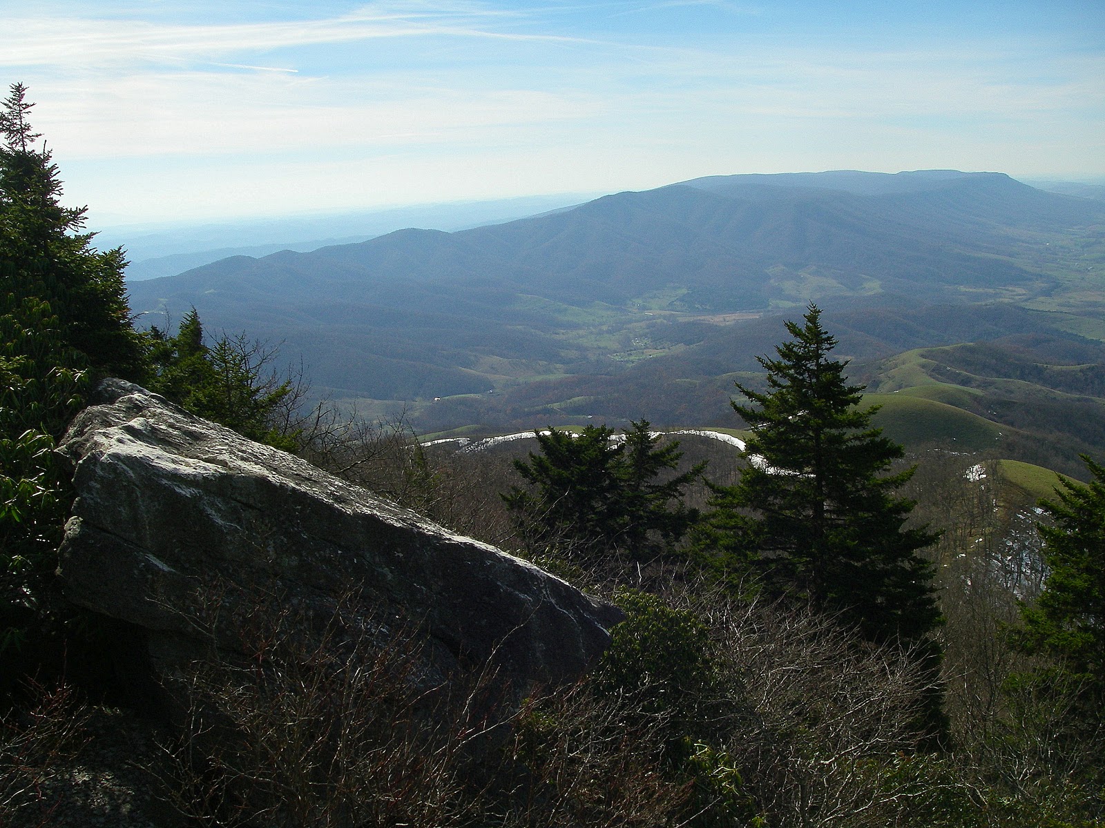
Atop Reinhart Knob completing the South Beyond 6000 Challenge some 20 years after I started it. Photo by Peter Barr

What to write about in my very first blog post? Since it will be a frequent topic, I suppose it would be appropriate to talk about this hobby of mine, this thing I like to do and often obsess about - peakbagging.

Peakbagging is the act of getting to the highest point of a mountain for the purpose of being able to say one has been there. And because the peak is on a list. After you visit the peak, you get to check it off the list, a simple but pleasing act. The thing is though, is that there is an infinite number of lists. You can concentrate on as many, or as few, as you like. You can work on established lists or you can even create your own. Peakbagging is a relatively obscure activity here in the Southeast, though that is slowly changing. But it has long been extremely popular among hikers in the Northeast and certain other areas of the country such as Colorado, California, and Washington. It’s a great way to explore areas that you never would have thought of otherwise. Some of these end up being as awesome and rewarding as far better known destinations. And it gives one goals to work toward, unending challenge and variety, and a deep sense of satisfaction upon completing a given list. Of course, all of the peaks may not be great and some may be downright unpleasant and incredibly difficult to get to. Depending on the specific list, many peaks also present issues such as being trail-less or on private property to deal with, but surmounting these obstacles only adds to the feeling of achievement. But the biggest reason for peakbagging is a love of mountains and an overwhelming desire to visit as many as possible. And to enjoy the quest.

Most lists are based on certain criteria. The most common, and most popular,  is elevation - such as all the peaks in Virginia above 4,000 feet, or all the peaks in Colorado over 14,000 feet. Or it can be a set number, such as the Highest 50 in Virginia or the Highest 100 in the Southeast. You don’t want to consider every tiny bump on a mountain as a separate peak so most of these lists use a prominence (more on that later, but very basically, how far a peak rises above the ridgeline connecting it to other peaks) cutoff to determine what actually counts as a peak. In most mountainous areas of the U.S. the generally accepted cutoff is 300 feet. A notable exception is New England where 200 feet is widely accepted as the prominence cutoff. Anything less doesn’t count as a ranked peak - though it may still be well worth visiting for views or other reasons. The table below from Lists of John clarifies this. Haw Orchard Mountain is ranked as third highest in Virginia based on P300’ even though three named summits are higher, the reason being that those three summits are nothing more than minor bumps with as little as 80’ of prominence.


A closely related tangent is Highpointing. This includes such lists as doing the highest point in each state or the highest point in each county of a given state. Prominence does not matter here, only that one reaches the highest point in a given geographical area. While it may well be a major peak, it does not necessarily have to be. It may not have even 50 feet of prominence if it is in a flat area like a coastal plain. It doesn’t necessarily have to have any prominence or even be on top of a hill. This happens when the highest point in a county is along a boundary line that doesn’t actually cross the summit of a mountain but only across its slopes. A prime example is Greene County in Virginia. Where the county line crosses the south slopes of Hazeltop (whose summit is entirely in Page and Madison Counties) happens to be the highest point in the entire county. This is known as a “liner” and most are about as unexciting as you would expect. But it’s still the highpoint.


Another commonly used criteria for lists is prominence. Generally speaking, the actual summit elevation is irrelevant. What matters is how much a peak rises above and dominates its surroundings. This is a simplified explanation, but all peaks (excepting Mount Everest and most continental and island highpoints) are connected by ridgelines and watershed divides to a higher peak somewhere. This may be the next peak on the ridge or it may be miles and miles away. But somewhere along these connecting ridges is a gap, the lowest of perhaps several. The height our peak rises above that saddle is its prominence, and as shown in the photograph at the upper right of http://www.cohp.org/prominence/index.htm . Another way of looking at it is to imagine any peak, any peak at all. Then imagine raising the sea level until the very moment that peak becomes the very highest point on its very own island. The distance above the new sea level is the prominence of that peak. There may be other peaks on the island, some with considerable prominence themselves, but they will all be lower than the peak in question. An excellent resource for learning more about prominence is the cited web page above, and all of the links located there."

 Like the elevation lists, there are variations. One can pursue a list of the most prominent peak in each state or county and it’s not always the highpoint - though it often is. Or one can set a cutoff, the most common being 1,000’ (P1K), 2,000’ (P2K), and 5,000’. The latter is termed an “Ultra” and there are only 57 in the continental U.S. Thus far, only 8 people have completed that list of 57 ultras. Virginia has 1,554 peaks with 300’ of prominence but only 106 have 1,000’ or more. Of those, only 9 have 2,000’ of prominence and none are ultras. Or one can climb a set number, for example, the 50 Most Prominent in the Southeast. The general feeling about large prominence peaks is that they are major stand-alone peaks, not merely one of several modest peaks in close proximity to one another. World-class mountains with significant topographic prominence include Mount Rainier and Kilimanjaro.

Other criteria might include isolation (the distance from the nearest higher peak), steepness, or simply all the peaks in a given geographical area like a county or a national park.

Then there are club lists. They may well be based on one of the criteria already mentioned, usually elevation, but can include anything a group of people deem worthy. They can be quirky at times but are also extremely popular. Many might say they are often non-objective as they sometimes make exceptions for peaks that don’t even meet their own criteria. They do this by including peaks that are otherwise interesting or to make the list contain a certain number of peaks. They sometimes allow substitutes for various reasons such as access issues and at least one even requires that four of the peaks on the list be climbed a second time, in Winter. Another eschews the above criteria entirely except for the fact that the peak must be below 4,000’. That one is in the White Mountains of New Hampshire and is called 52 With A View and is designed to get people to visit some of the lower peaks that are interesting while taking some of the attention and crowding off of the extremely popular Four-Thousand Footers in the state. Some also require minimum hike distances and elevation gains before the peak can be counted. But to each his own and there is a place for lists that are subjective or based purely on aesthetics. Perhaps the most popular list in the Southeast is the Carolina Mountain Club’s and Tennessee Eastman Hiking and Canoeing Club’s South Beyond 6,000 Challenge. This involves summiting the 40 peaks in the Southern Appalachians that are above 6,000’ in elevation. Several of these are quite remote and do not have official trails, only “manways” that can be difficult to find and stay on. About 200 people have completed this list so far. Just as a comparison to the popularity of peakbagging in the Northeast, over 7,300 people have completed the Adirondack 46ers list in New York. But that just means there is still a chance to get in early on some lists in the Southeast - maybe even first like my good friend +Peter Barr who was the first person to complete all 200 Southern Fivers with 200’ of prominence and is poised to be the first to complete all of North Carolina’s P1Ks.

One can concentrate entirely on one list or one criteria such as County Highpoints or peaks with at least 1,000’ of prominence, or peaks in a certain state above a certain elevation. Or you can work on as many different lists as you like. You can also mix and match different lists. One acquaintance of mine likes doing peaks with a lot of isolation, usually at least 25 miles. But he, personally, doesn’t really consider it a peak unless it has at least 1,000’ of prominence. If it meets both criteria then he wants to climb it - no matter where it is.

The best way to get started is to visit one of the sites below. There you can find various lists and sometimes even trip reports to learn how other people got there. All three also allow you to create an account so that you can enter your peaks and track your progress on various lists. All three have their strengths and weaknesses but all three are wonderful resources.

http://www.listsofjohn.com/ Lists of John is an amazing website created by John Kirk of Colorado. His database contains every single peak in the U.S. with 300’ of prominence and this includes all unnamed peaks as well - and there are a LOT. The database also contains nearly every named peak and county highpoint in the country, even if it has less than 300’ of prominence. The sole exception is Alaska which he has only completed down to 10,000’ in elevation at this time. It allows you to enter the peaks you climb and keeps track of your progress on various lists. It also allows you to create custom lists which you can keep private or share with all the other 1,700+ users of the site. I am still discovering functionalities on this site.

http://www.peakbagger.com/ Peakbagger is owned by Greg Slayden of Washington and has about 2,500 active users. It doesn’t contain every P300 peak in the U.S. like Lists Of John but it is international in scope. There are many predetermined lists on the site, but you can also select your own parameters (elevation, location, prominence, etc.) to run a query, generate a peak list, and, if you like the results, save it as a list. You can also add peaks to the database if they aren’t already there, a very nice touch. They are considered provisional until Greg approves them.

http://www.cohp.org/ County Highpointers is owned maintained by Adam Helman of California. This is the place to go for all things related to County Highpointing, including trip reports and keeping track of your progress. The holy grail for most county highpointers is the state completion - reaching the highpoint of every county in a state and and a task varying enormously in difficulty ranging from Rhode Island to Alaska. As a 'boutique website' specifically for that ONE genre, the ranks of county highpointers will never be large, but the roughly 200 registered users form a very active and passionate group with a lively forum. There is an automated system like the other two sites but one of the real treasures is the ability to create custom completion maps that you can have Adam update periodically, some of which are virtual works of art.

Wordy though I have already been, one could add much, much more to this post and still only scratch the surface. The important thing is simply to pick some peaks, get out there, and start exploring.