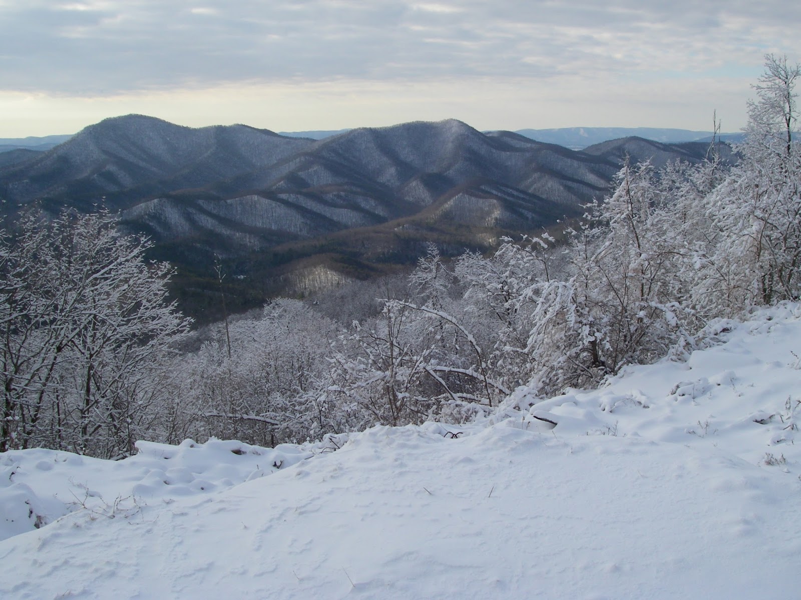
Showing posts with label bushwhacking. Show all posts

Friday, January 31, 2014

Peak 2310 And Pinnacle - Up High, Down Low


Depending on where you are in the Appalachian Mountains, the “High Peaks” can be those over four, five, or even six thousand feet in elevation. There is also a tendency to sometimes think that these are the premier peaks, and the only ones worth hiking. But despite my own personal guilt of sometimes thinking of the same way, the truth is that in the big scheme of things, even the higher Appalachian Mountains are a pretty lowly bunch. That said, another truth is that the measure of a mountain's worth can be based on many things other than its elevation. Some people hike or climb mountains based on their prominence or their isolation. There is even a dedicated group of people who collect county highpoints, that is the highest point of every county they can visit, no matter how high or low it is. Yet others base their interest on more subjective or aesthetic criteria, like a mountain's appearance, it's difficulty, or perhaps most often, on how good the views from the top are. Some people have yet other reasons. Actually, I like to think I usually give all of these things, and more, their due consideration.


Peak 2310
While I can’t deny that I like climbing peaks that are on a list of the highest or most prominent in a region, the ones I feel most drawn to are those that have great views. If the peak itself is scenic or dramatic in its own appearance, that is another big plus. And if the route up it is steep, challenging, and fun, then that is yet another great appeal. While the higher peaks often do have all of these qualities in spades, they are not exclusive to them by any means, and many lower mountains can also have these same qualities. Such is the case with unnamed Peak 2310 and the nearby and slightly higher Pinnacle.


These two lowly peaks are part of a thirty mile long line of similarly elevated prominences that form the western front of the Blue Ridge from Glasgow to Vesuvius, and average 1,000 feet or more lower than the summits that form the true crest of this section of the range. Despite that, most of them are rather steep, pointy, and rugged. In fact, while these low peaks don’t show up on the more common peakbagging lists, nine of them rank in the overall steepest 100 peaks in the state. Four of them, including Peak 2310 and Pinnacle, are in the top 50. There is no doubt that they are true peaks in their own right, despite the fact that my desk at home in Wytheville where I am writing this is almost identical in elevation to Peak 2310 - which happens to rank as the 945th highest peak in the state. Most also have the distinction of being trail-less, and I would hazard to guess rarely visited - at least by hikers. I certainly haven’t encountered anyone else during my treks in the area. I first visited these two peaks on separate hikes back in early 2012, first doing Pinnacle and Target Hill, then climbing Peak 2310 and Three Sisters Knobs a couple months later. Each of the two this post focuses on had the distinction of being the best of the two peaks I climbed on each trip, and I knew I wanted to come back again sometime, hopefully with a friend to show them off to. My buddy +David Socky  was up to the challenge, as usual, and we picked a nice, clear Winter day to meet up.


Pinnacle

Sticking with the route I used the first time, we headed up a gated Forest Service road that leads into the Davidson Run drainage, then veered off of it onto the western ridge. This climbs east, then northeast to the top. This is entirely off-trail, and while it is a bit brushy in spots and there are a few briers, overall the bushwhacking is not too bad. The need to curse is only sporadic. Along the way on the uppermost several hundred vertical feet, however, there are a number of rock outcrops with fun scrambles and great views ranging from south to west to northwest. Some of the peaks visible include Three Sisters Knobs and Apple Orchard Mountain in the contiguous Blue Ridge. Most of the views, however, are of peaks across the Great Valley in the Alleghenies, like Short Hills, the impressive cone of Sugarloaf Mountain, Big House and Little House Mountains, Big Butt, and Jump Mountain. Once on top of this lowly 2,310’ peak, there is also a view of more Blue Ridge peaks, including Pinnacle, Bluff Mountain, and the 4,000 Footer of Rocky Mountain. All in all, it is surprisingly fun and impressive for a mountain whose elevation is slightly lower than a significant portion of the town I live in and about the same as my apartment. We went down the more northerly of the two western ridges. It doesn’t have any real views but is easier going and makes for a nice loop.


Dave scrambling up the west ridge of Peak 2310
The scrambling continues
Big Butt and Jump Mountain from Peak 2310, awesome hikes themselves.

Once we got back to the car, before heading for Pinnacle, we crossed the road and did a fairly quick and easy hike up Brady Hill. This was uneventful other than Dave getting rather bloodied and cut up by some wicked thorns near the very beginning. There weren’t any views from this 1,529’ mountain, but it did have some nice open woods and was a new ranked peak for me - Number 1,446 out of 1,615 total peaks in the Virginia elevation rankings to be exact. Neither the Virginia 1ers, nor the Virginia Highest 1,500 are lists I aspire to make much progress on…

We drove another mile-and-a-half up the road to the start of the old, now abandoned Belle Cove Trail to begin the trek up Pinnacle. The information I have been able to find indicates that this trail was devastated as a result of a week long period of sustained and heavy rain that occurred over a large area the central and northern Blue Ridge June of 1995 and caused a lot of flooding and a considerable number of landslides in the mountains. It never was reopened, but the lower end still makes a good approach trail for climbing Pinnacle. I assume that one of the neatest features of Pinnacle is a direct result of that same weather system nearly twenty years ago. About a mile up the trail is a tiny tributary of Belle Cove Branch that drains part of Pinnacle’s west side. It is very narrow and confined in a steep-sided ravine, but if one follows it upstream for about 250 yards, it leads to the base of a small but genuine Adirondack-like slide on the north side of Pinnacle’s major southwest ridge. The size of the small pine trees now growing back would seem to agree about the age of the slide. Here a 250 yard long and 50-100 feet wide section of the mountain shed its surface down to the underlying bedrock, taking the trees and soil away. I was very excited to find this open slide on my bushwhack up Pinnacle in January of 2012. It made a great climb with awesome views that got better and better the higher I got, and made me feel like I was in the Adirondacks. The slope is moderately steep, but in dry conditions has good footing, and there is no bushwhacking since it is mostly open - at least for a few more years anyway - being mostly bare rock and loose cobbles. Unfortunately, it wasn’t quite as much fun when Dave and I did it. There was just enough snow and ice on the slide to make it treacherous, but yet not enough to justify breaking out our microspikes. The result was that we clung to its edges, partly in the trees and shrubs. But it only took a step or two out into the open to again enjoy the great views to the northwest, where House Mountain in particular is very prominent. Too soon, the slide narrows and ends, and it is very obvious the exact spot the slide started, there even being a small headwall of sorts.

This little gorge and unnamed tributary of Belle Cove Creek leads to a great slide on the southwest ridge of Pinnacle.
I was excited to find this open slide on my first bushwhack up Pinnacle. It made a great climb with awesome views that got better and better the higher I got and made me feel like I was in the Adirondacks
On this visit, there was just enough snow and ice on the slide to make it a little treacherous, but not enough to justify putting on our microspikes - so we ended up hugging the edge for better footing.
Little House Mountain in front of Big House Mountain, seen from the slide on Pinnacle.
From this point, we continued southward and perpendicular a short distance farther until we hit the crest of the peaks main southwest ridge. From here on to the top, there are a number of outcrops on the rocky ridge that provide some easy but fun scrambling and more expansive views than the slide offers. One of the first is a great view south of the conical form of Peak 2310. Continuing higher, from various points along the way, there are views in most directions that take in such sights as Apple Orchard Mountain, Purgatory Mountain, The Knob, Short Hills, a very impressive looking Sugarloaf Mountain,Target Hill, Silas Knob, and Big Rocky Row among them. All in all, it is as rewarding and challenging a climb as almost any of Virginia’s 4,000 Footers. Just like Peak 2310, and unlike more than a few of the 4,000 Footers, there is no doubt where the exact summit of this pointy peak lies. We touched a foot to it, enjoyed some more views while we had a snack, then headed down the north ridge to a yet a couple more viewpoints. At the last of these, and around the 2,000 foot elevation, we deviated from my previous descent route when I was also going after Target Hill, and headed down a minor ridge in a northwesterly, then westerly direction to a saddle crossed by an old woods road a thousand feet lower. From here it was a mostly easy walk back to our starting point and the end of another great adventure in the mountains of Virginia.

Scrambling on Pinnacle
An overlook near the top of Pinnacle
To see the topo map larger on this site, click on the map. Or click here to see a larger interactive version on Gmap4.
Elevation profile for Peak 2310 and Brady Hill

Elevation profile for Pinnacle

Hike stats:
Peak 2310 and Brady Hill - 4.85 miles, 2,220' cumulative elevation gain
Pinnacle - 4 miles, 1,701' cumulative elevation gain

More pics:

Resources:

Trailhead coordinates for Peak 2310:  37.6619, -79.4204

Trailhead coordinates for Pinnacle: 37.6799, -79.4067

created with Chrome OS, Android, and various webapps

Saturday, January 4, 2014

Griffith Knob and Peak 3681 - Unknown And Unnamed Isn't A Bad Thing


Griffith Knob and Peak 3681
All of the best hikes are not documented. Sometimes I think about writing a small booklet titled “The Best Unknown Hikes of Southwest Virginia”, or something similar to that, and having a listing and descriptions of local favorites, close to home but worthwhile outings, and obscure but great locales that may be either on or off trail. They might be long or short, difficult or easy, but the one thing most would have in common is that while some may be well known locally, they have been rarely or perhaps even never documented on anything other than a limited scale. Regionally well known hikes like Mount Rogers and The Cascades would not be included in this category unless they were incidental to a lesser known nearby spot, though it might be somewhat subjective on my part as to what is well known and what is not - and what is worthwhile. Most might not make it onto a list of the best hikes in the Southern Appalachians (though some could), but all would be worthwhile and of interest to someone in the area who didn’t want to drive several hours to a good place to hike, or didn’t want to be gone all day. Most of the hikes would be on public land, but if I knew that a landowner welcomed hikers, then some destinations could be on private property. Whether or not such a book ever comes to fruition, it occurred to me that I can pursue that idea in this blog from time to time. One such hike would be Peak 3681 and 3,782’ Griffith Knob in Wythe County, a half day (or less) hike little more than 20 minutes away from my home in Wytheville.

These two peaks are on Brushy Mountain, located in the northern part of the county only a few minutes from U.S. Highway 52, and are within Jefferson National Forest. Respectively, they are the seventh and fifth highest peaks in the county, and the higher Griffith Knob is also the most prominent peak in Wythe County. It should be pointed out that part of this hike is quite steep and on very faint trails, and part of it is completely off-trail, albeit in relatively open woods. As such, it is probably best done in cooler and less vegetated months. The views will also be better then. It is also easy to do only Peak 3681 for a round trip of only around two miles, though because of the route, there is little reason to not include the short side trip to the top of this one even if the primary goal is only Griffith Knob.

Mount Rogers and Whitetop from Peak 3681.
The hike begins at an unmarked pullout on FS 221 only a couple miles from Deer Trail Park. There is an obvious but unmarked path at first, perhaps made by hunters, that starts at the upper end of the parking area, and immediately begins a moderately steep 700’ climb up one of the northeastern ridges of Peak 3681 to the main crest between the two peaks but high on the shoulder of Peak 3681. The path becomes increasingly difficult to see as you climb higher, something to be well aware of for the return trip when it will be surprisingly easy to veer off onto the wrong ridge, but as long as you stay on the crest of this spur ridge going up, you will get to the right spot, hitting the main crest at about the 3,500’ elevation. Take special care to remember this exact spot. From here, turn west and continue upwards less steeply for another 3/10 mile to the top of Peak 3681. There are no wide open views here, but there are at least three spots with limited but pleasant views in different directions. From very nearly right on the summit, there is an outlook to the northwest of Walker Mountain, and peeking above its spine are the more distant and higher peaks of 4,409’ Chestnut Knob and 4,710’ Balsam Beartown, both on the rim of Burkes Garden. A few yards down the northern ridge is an outlook to the east that takes in the valley of Stony Creek between Big Walker and Little Walker Mountains. To wrap things up, one can wander perhaps 50 yards down the southern ridge and find a couple of decent sized openings in the canopy that allow some nice views of Mount Rogers and Whitetop, as well as a swath of the Iron Mountains. Again, none of these views are wide open, and they will be better when the leaves are off the trees - but they are all pretty pleasant scenes and ones that I find quite appealing.

Admiring the view of Stony Fork Valley and Little Walker Mountain from Griffith Knob.

After taking in the views, simply return back to the spot where the crest of the ridge was attained on the first leg of the hike - and again, remember it well, as it is easy to miss. At this point, you should head downhill about 1/10 mile along the southeastern ridge, losing a couple hundred feet of elevation, then regaining it to the top of the next unnamed knob at 3,640'. At this point, continue eastward on an old woods road, losing only about 50' before making a final 200' climb up Griffith Knob. It should be mentioned that the rest of the route is on the boundary between National Forest and private property, so don't please don't wander off the ridge crest to the south or east. There is no view from the top, but this is the most prominent peak in Wythe County and knowing that gives a certain satisfaction of its own if one cares about such things. Incidentally, when viewed from several miles away to the east, especially when the leaves are off and there is a bit of snow on the ground, the broad top surrounded by steep slopes and horizontal rock banding give this mountain a very “Catskillian” look that is quite impressive.

The conspicuous peak of Floyd County's Buffalo Mountain seen from Griffith Knob.


One might as well have the views too though. About ¼ mile down the north ridge, where it begins to narrow and then drop off more abruptly, there is a small clifftop opening a few yards off to the right. This is easily the best view of the hike, with an open arc of the landscape to the east and southeast. Little Walker Mountain, Queens Knob, and Sand Mountain are all in plain view and the solitary volcano-like and symmetrical form of Floyd County's Buffalo Mountain is very conspicuous to the southeast on a clear day, despite its being 44 miles away. This is a great spot to hang out for a while and enjoy what will almost certainly be complete solitude. On the return trip, hope you were paying enough attention to your route to avoid going down the wrong ridge anywhere, something that would be very easy to do in at least four different areas. A recorded track on a GPS could be much appreciated now, but it is still better if you made a mental note of key direction changes on your way here.
This hike is not going to attract crowds of people from all over the Southeast, or even the state. However, if you live within an hour or so, and are looking for something new and different, but not without some rewards, this is one of those little known hikes that can fit the bill. There are many more...


To see the topo map larger on this site, click on the map. Or click here to see it on CalTopo.


Elevation profile for this hike.

Hike stats: 4.2 miles, 1,950' cumulative elevation gain

More pics:

Resources:

Trailhead coordinates: 37.0120, -81.2283


created with Chrome OS

Saturday, November 2, 2013

Bluff Mountain And Hellgate Ridge - Neglect and Rediscovery


Sometimes you realize that you shouldn't have waited so long to do a hike again. Such was my case with Bluff Mountain. I had hiked the Appalachian Trail up this mountain once before, way back in 1994. I don't really remember what I thought of it then. Maybe it was hazy, or maybe I just didn't feel like writing, because my journal from that day only makes mention that I was there. But I still knew it had a view and so it seemed like it was time to rediscover it. I've been very close to it again quite a few times during the intervening years, on a number of hikes to Rocky Row, and also to several other nearby peaks like Pinnacle.

It is a very conspicuous peak from a number of more distant viewpoints throughout the region. One reason for that is that despite its modest elevation of only 3,372', it is the most prominent peak along a 26 mile stretch of the Blue Ridge and dead center between the even more prominent, but less distinctive peaks of Apple Orchard Mountain and Rocky Mountain. It is one of only 106 mountains in Virginia to have over 1,000 feet of prominence and rises to a fairly small summit. These qualities make it stand to reason that it was once a firetower peak, and should command an extensive view. It was time to refresh my memory...

My approach the first time had been on the Appalachian Trail, but several explorations of other peaks in this area had brought a potentially interesting, and more challenging option to my attention. Assuming the Forest Service map was correct and there was public access at the start, the topo showed a pipeline and attendant service road going up Bennetts Run, then making a near beeline most of the way for the summit from the northwest. Satellite imagery seemed to confirm the same and so a plan was made. My frequent hiking companion +David was free, and up for a good hike, so off we went to explore.


Looking back at Pinnacle.
We found the gated Forest Service road and began our hike at an elevation of only 900', leaving a respectable climb to the top. The route was a bit confusing at the beginning as we skirted around a large car junkyard on private property, then tried to follow a more obscure woods road to the pipeline. We lost it in brush and briars and had to just cut through the woods to find the pipeline, only to discover it too was pretty brushy, with waist high greenery still not quite knocked down by the return of cold weather. This would not be fun in the green months but nevertheless led us up Bennetts Run, and between the peaks of Pinnacle and Target Hill (both worthy destinations themselves) to the point where the small stream split into its North and South Forks. The hiking became much more interesting at this point, as the pipeline abandoned the overgrown drainage and climbed steeply straight up the fall line of the Northwest Ridge of Bluff Mountain. The route became a rocky treadway, a narrow road really, and climbed up through open woods with some occasional views behind us of Pinnacle and Target Hill, and through the “V” they create, which allowed us to see part of the fog-laden Maury River Valley and the ridges of the Alleghenies beyond. The grade eased briefly in a couple areas, but overall it remained a fine, steep ridge that was relatively narrow and scenic. I liked it a lot!


Rocky Mountain and No Business Mountain.
Finally, at about the 2,500’ level, the pipeline veers abruptly south to drop down a few hundred feet in elevation, then climb again to the shallow gap separating Bluff Mountain and Hellgate Ridge. The ridge we were on looked more appealing than ever now, and we certainly didn’t see any reason to lose elevation, so we opted to head off-trail and continue on our current course to the top, which was now only ¾ of a mile away, albeit still over a 800 feet higher. There was a bit of scrambling, some limited views, and a bit of rhodo-whacking to round things out, but all in all it was a fine little climb. A short distance from the top, we hit the old fire tower access road and followed it the remainder of the way.


The panorama West and North from Bluff Mountain looks across the Great Valley to Big Butt, Jump Mountain, and Great North Mountain in the Alleghenies as well as toward such Blue Ridge summits as Whites Peak and Adams Peak.
Though the lookout tower that would have allowed a 360° panorama is sadly now long gone, the semi-open summit did not disappoint. Between the hardwoods and a curious handful of red spruce - usually found considerably higher or farther North, there was a great view to the south of High Peak and No Business Mountains, with the vast flattening of the Piedmont extending beyond to the limits of the horizon. But the real reward was the sweeping view of mountainous country to the North and Northeast. Close at hand were many of the low, but steep, rugged, and pointy peaks that form the western front of the Central Blue Ridge in Virginia. Among these were Elephant Mountain, Garnet Peak, Silver Peak, Whites Peak, and also Adams Peak and McClung Mountain - the last two personal favorites. To the left of all those peaks was a long swath of the Great Valley, with Buena Vista and Lexington both in sight. Beyond the valley rose the long wall of the Alleghenies, with House Mountain, Big Butt, Jump Mountain, and Elliot Knob all plainly in view along with many others. I have no intention of allowing twenty years to pass again before a third visit.

A neat pinnacle on Hellgate Ridge.
Rather than backtracking on the return hike, we followed the Appalachian Trail south a short distance, then headed off-trail again to traverse Hellgate Ridge. This was rather thick in places, but we did find a neat pinnacle on the ridgeline, as well as a small clifftop overlook with views of Silas Knob and Big Rocky Row. We also found a limited, but great view of conical Peak 2310 and impressive looking Sugarloaf Mountain.

We should have continued along the ridgeline to the top of Pinnacle for more great views and another summit for the day, but instead we dropped back down to Bennetts Run from the low spot on the ridge. This required some very steep and tedious sidehilling, and dealing with a lot of fallen trees near the creek before climbing back uphill again anyway to regain the pipeline trail. From there is was easy walking on now familiar terrain, and we found and successfully followed the faint road we had lost near the beginning of the hike. It will serve me well in the not too distant future when I do this hike again. I’m not going to neglect this great peak again now that I have rediscovered its treasures.

A minor viewpoint on Hellgate Ridge, looking toward Silas Knob and Big Rocky Row.


Route of the Bluff Mountain hike. To see a larger map click here.
Note: There seems to be a problem with the default map view I have selected not showing properly. Please select the map you prefer from the drop-down menu in the upper right hand corner of the map.

Add caption
Hike stats: 9.25 miles, 3,280' cumulative elevation gain

Pictures from this hike.

Resources:
gpx, kmz, topos for this hike

Trailhead coordinates: 37.68971, -079.39118
Google Map for trailhead


Saturday, March 23, 2013

Anthony Knobs and North Mountain - Caves and Cliffs

Near Pete's Cave. Photo by Dave Socky

I had another great day exploring new peaks and new views in the mountains of Virginia, and enjoying some old views again to share them with friends. Today I joined up with Tommy Bell and +David Socky to hike up Anthony Knobs in the Allegheny Highlands, then doing a second hike nearby.

Wanting to hike a loop over Anthony Knobs first, we found the road to the trailhead at the Longdale Recreation Area to still be gated and closed for the season. This would have necessitated an extra two miles or so of hiking on the road, but by driving a few more miles, we were able to start at an alternate trailhead farther south, along Sinking Creek.

Looking over the Cowpasture River Valley towards Rough, Mill, and Brushy Mountains from Anthony Knobs.
Only problem was that we couldn’t find the trail we were looking for which the map showed heading straight for the top of the mountain. We did find a trail, but it was a hideous tangle of blowdowns and we quickly decided we weren’t going that way. Back at the trailhead, we found what was apparently the other leg of the loop, heading back toward the first trailhead. We decided we would follow it and see where it went, and make any adjustments or bushwhacks that might be required to do the loop I had in mind. We soon turned uphill on an old woods road and seemed to be moving onto the shorter of the two possible loops here. It eventually turned into a footpath and didn’t seem to exactly match the map I had, nor had it been maintained in some time - but it generally went the right way, and I tend to enjoy following faint and abandoned trails, and seeing where they go. Sure enough we eventually gained the crest of the mountain and a trail sign.
 
Dave on a steep slope.
 The continuation towards the Longdale area was obvious, but thanks to a blowdown, it took a little looking to spot where it headed toward the top. After a short distance, it became a sidehill trail on a steep slope, not a ridgeline trail as the map showed. It kept going the right way though, and eventually ran onto another old woods road. This took us to the edge of the National Forest boundary and private property, but there are some views to the southwest from here, as this is the edge of an old clearcut. The steep-sided summit cone of the 2,460’ peak is also in view, but is just off of the National Forest. It is possible, however, to bushwhack up to the ridgeline along the boundary line and also get some good views to the north, towards Iron Gate, Griffith Knob, and the mountains around Douthat State Park.

The next challenge was finding a reasonable way down. There was absolutely no trace of a trail where the map showed one descending easterly along the boundary line, and we didn’t want to end up in the tangled mess we had attempted to start the hike in. Fortunately, Dave had noticed that his gps showed a trail a little farther northeast, which descended back to the valley. Incidentally, this trail is not on the USGS topo, the USFS topo, nor the Trails Illustrated map of this area. But, lo and behold, after spreading out across the hillside where it supposedly started, we actually found it.
Tonka getting a drink.
The upper part was faint, had a number of blowdowns across it, and varied a bit from what the gps showed, but it was there and even had some faded old blazes. It got a little more distinct farther down and eventually merged onto the trail shown on the paper maps - of which there was no sign of it continuing up the mountain. Surprisingly, and a bit embarrassingly, it came out right at the spot we had hoped to start the hike from, in the one spot we hadn’t looked at closely enough because there was a large mud puddle there. It even had a piece of flagging at the start which we had all three somehow missed seeing! But all’s well that ends well, and we headed for the next hike.
Tommy and I atop the cliffs of North Mountain. Photo by Dave Socky
I had done most of this hike once before with my girlfriend +Leanne, and Tommy had also been on the first half mile or so of it with me last year. But there is more to see, and farther to go. Big rewards come quick, as there are several spectacular cliff-top views south and east in the first 3/10 mile that include Big Butt, Big House and Little House Mountains, and many peaks in the Central Blue Ridge. This is followed by 2 ½ more miles of easy hiking on a nice ridgeline trail to an area of massive sandstone blocks that provide more great views, one of House Mountain from a different perspective, as well as great views north that include Anthony Knobs and many of the same mountains we could see from there. There are also a couple of large talus/fissure caves just off the trail in this same area. One is more of a narrow corridor between two blocks, open to the sky at first, with the back half under a roof and more cave-like, with a total length of perhaps 150’. The larger one, which we didn’t actually climb down into because of wet, muddy rock above a 10’ drop (I know, that’s a pretty lame excuse) - and assuming it is indeed the correct one - is known as Pete’s Cave, and supposedly has around 400’ of passage.
Dave in the fissure passage of "Not Pete's Cave".

We continued a few tenths of a mile farther and made a short off-trail jaunt to the top of Peak 3260, something I hadn’t done on my first hike here with Leanne. This is a so-called soft ranked peak, because based on the contours of the topo map it has an interpolated, or average, prominence of less than 300’, but whose same unknown true summit and saddle elevations could very well give it an optimistic or “dirty” prominence of over 300’. The number of such peaks is not insignificant. Virginia has a total of 1,554 ranked peaks, based on having a minimum of 300’ of average prominence. That is to say that if you wanted to compile a list of every true peak in Virginia ranked from highest to lowest, you would have a list that started with 5,729’ Mount Rogers in the #1 spot and 791’ Mount Pony at the end of the list at #1554. Wilburn Ridge, at 5,540’ is ostensibly the #3 peak , but it only has 160’ of prominence - a minor bump, not a peak - so it doesn’t count. However, there are an additional 169 of these “soft” ranked peaks that don’t fall within those rankings - but quite possibly belong there. If you’re working on completing a peaklist based on elevation, these are often nagging peaks that you wonder if you need to do “just in case”. Ah, the things peakbaggers worry about...
Dave in the jumble of talus near Pete's Cave.

But just because a summit isn’t ranked, that doesn’t mean it isn’t worth visiting. Not at all. Wilburn Ridge is arguably the most spectacular spot in Virginia, certainly one of them. Likewise, while Peak 3260 doesn’t deserve any such accolades, there was nevertheless a small outcrop at the very top that had some good views to the south, and a rather spectacular view of Big House and Little House Mountains, justification enough for climbing it in my book.

On the outcrops near Pete's Cave, with Anthony Knobs, Rich Patch Mountain, and Nicholls Knob in the distance.
 
Big Butt, Big House Mountain, Little House Mountain, and the distant Blue Ridge from Peak 3260.

The route of the Anthony Knobs loop. To view a larger map click here.

The route of the North Mountain hike. To view a larger map click here.

Hike Stats:
Anthony Knobs loop - 6.25 miles, 1,600' cumulative elevation gain
North Mountain and Peak 3260 -  8.3 miles, 1,360' cumulative elevation gain

Pictures from these hikes

More pictures from North Mountain
April 2012
October 2009

Resources:
gpx files and maps for Anthony Knobs
gpx files and maps for North Mountain
USFS page for the Anthony Knob Trail
USFS page for the Blue Suck Run Trail
USFS page for North Mountain Trail
Hiking Near Lexington


View Larger Map
Anthony Knobs trailhead coordinates:
37.75941,-79.71785
Google Map for trailhead

Scan QR code to navigate to trailheads with Google Maps on your smartphone:


View Larger Map
North Mountain trailhead coordinates:
37.819,-79.63468
Google Map for trailhead

Scan QR code to navigate to trailheads with Google Maps on your smartphone:


Saturday, February 9, 2013

Clinch Mountain - The Back Of The Dragon


As I turned onto Route 16 North in the town of Marion, Virginia recently, I noticed a sign I hadn’t seen before proclaiming the road “The Back Of The Dragon”. While perhaps an appropriate moniker for this very curvy road that very nearly makes a complete loop at one point, I couldn’t help but think it was a knock-off on the section of US Highway 129 that winds around the western end of Great Smoky Mountains National Park. That is another exceptionally curvy road that has long been referred to as “The Dragon” or “The Dragon’s Back”. As it turned out though, the name seemed like a great way to describe the hike I was about to do. After a slow two dozen miles across Walker and Brushy Mountains, then up Clinch Mountain, I parked on the crest of the latter and stepped out into an icy wind to begin the day’s adventure. 

I had done the first two miles of this hike before, years ago, so I knew there were some good views, but I had forgotten just how spectacular this route was, and knew nothing about what lay beyond where I had turned around last time. Almost immediately the ridgeline narrowed down to a few feet wide, and soon thereafter small drop-offs began to appear on one side or the other. The crest became increasingly narrow, until it was literally a sharp spine of bare rock, usually with a cliff on the north side and a steep slope on the south. While the cliffs were nothing like you would expect on an alpine arete on a major mountain, they were certainly high enough in many places to demand respect and sure-footedness. Without trees, it would have felt a great deal more exposed in many spots, and a fall would likely be fatal in several of these. Occasionally it would widen out a little, but rarely for more than a few yards. There were bits and pieces of either game or hunter paths, but for all practical purposes this hike was, and is, a bushwhack. Briers were quite abundant, but rarely so thick that I couldn’t pick my way through them. Usually, I found I was able to walk right on the knife edge, but at times there were overly thick briers, or the exposure became too great for comfort. Almost without exception I was able to bypass such difficulties on the south side by dropping down a few feet or yards, often still on the steeply sloping slabs of sandstone, many of which extended a considerable distance downhill.

Much of the first four miles along the crest of Clinch Mountain varied from narrow...
...to narrower...
...to even narrower.
Can you say knife-edge ridge?

A natural arch.
 After about a mile, some limited views begin to appear, and a little farther there is even a small natural arch which is perhaps four feet high and fifteen feet long right on top of the ridgeline. Then the real views begin to appear in steady succession, and the route becomes even more interesting, literally like walking along the back of a dragon.  At various points there are views in nearly every direction, a couple of them essentially 360° panoramas. There is also one particularly notable overhang at one point, which looks like the famous overhang on McAfee Knob tilted upward at a crazy angle. It begged for a person standing on it in the picture, but alas, I was alone.

A crazy overhang ahead needed a person on it.
There were lots of nasty thorns!
Ease through some briers, walk a knife edge, drop down the south side a few yards to bypass a difficult section, climb back up, enjoy an awesome view. Repeat. This was the process for much of the first four miles. The views included such sights as Mount Rogers and Whitetop, Chestnut Ridge, Knob Mountain, and Thompson Valley among others. Eventually the crest starts to broaden and the last good view is at around the 4 ½ mile mark. This would normally be a good turnaround point, but I had another goal in mind.

Ever since my buddy Shane Ashby and I finished bagging all the ranked (300’ prominence) Virginia 4,000 Footers three years ago, and actually, all the 4,000’ peaks down to 200’ prominence, I have slowly been knocking off the few remaining named, but unranked 4,000 Footers as well, just to say I’ve been on them. One of the eight remaining was just over a mile ahead now. Redoak Ridge is 4,580’ above sea level, but it is certainly no peak, only a bump with 80’ of prominence on the ridge extending southwest from the state’s sixth highest peak of 4,710’ Garden Mountain, a.k.a. Balsam Beartown - a major Virginia summit with over 2,000’ of prominence. It has a name on the map though, so I wanted it. It also didn’t hurt my desire that the top was white with rime, and I could see that there was some snow up there. I started getting into snow just a little higher up, around the 4,000’ elevation. A little higher still and the rime started to appear in the trees, always a beautiful sight. Then, near the top, red spruce started to appear and I was again in my favorite type of forest - the boreal. No views, but a beautiful spot nevertheless. ( Actually, in hindsight, there may be more views nearby after all. Upon studying satellite imagery while writing this, I noticed that there appear to be more cliffs just to the north of my route, which could look into the head of Thompson Valley and beyond.)


Great view west of Thompson Valley, Peak 4150, Short Mountain, and Morris Knob.
 Half of the next ½ mile was pure Hell, as I dropped down to the headwaters of Cove Creek and climbed back up to Beartown Ridge. The rhododendron near the creek was pretty hideous. I don’t think I had to crawl anywhere or take my pack off, but there were a few places where it took me most of a minute to take one step. Pry back the interwoven branches, tuck them behind my back, grab a couple more, climb up into the bush and take a jerky step forward, then repeat. It was slow going, with a few choice words uttered aloud. Much to my relief, it eventually thinned out into more open woods and I reached the top of 4,689’ Beartown Ridge, another unranked bump, but one I had been on several times before.
Looking toward Virginia's two highest peaks, Mount Rogers and Whitetop.
Rime on top of Redoak Ridge.


A little snow and rime up high.
This hike would actually make for an adventurous route to get to Balsam Beartown (less than 1 mile away now) and even Hutchinson Rock, but certainly not the easiest one. I decided to forego it this time though, and bushwhacked down to Roaring Fork and back up onto the south end of Chestnut Ridge. Then I made my way down into Poor Valley and began the long roadwalk back to my vehicle, though I was lucky enough to catch a ride the last mile or two. I can’t say I would recommend the latter part of this hike to anyone unless they went to the effort to have a second vehicle waiting at the Appalachian Trail parking lot in Poor Valley. In that case, it could make for a long but awesome trek, potentially including Balsam Beartown, Hutchinson Rock, The Swag, and the section of the A.T. on Chestnut Ridge. Regardless of the longer option though, I am already looking forward to eventually returning here with a friend to once again walk the “Back of the Dragon”.

The route of this hike. To view a larger map click here.
  
Hike Stats:
My hike - 14.2 miles, 2,940' cumulative elevation gain
To last good view (#29) and back -  4.6 miles, 1,560' cumulative elevation gain

Pictures from this hike

Resources:
gpx files and topos 


View Larger Map
Trailhead coordinates:
37.04104, -81.51839

Google map for trailhead

Scan QR code to navigate to trailheads with Google Maps on your smartphone