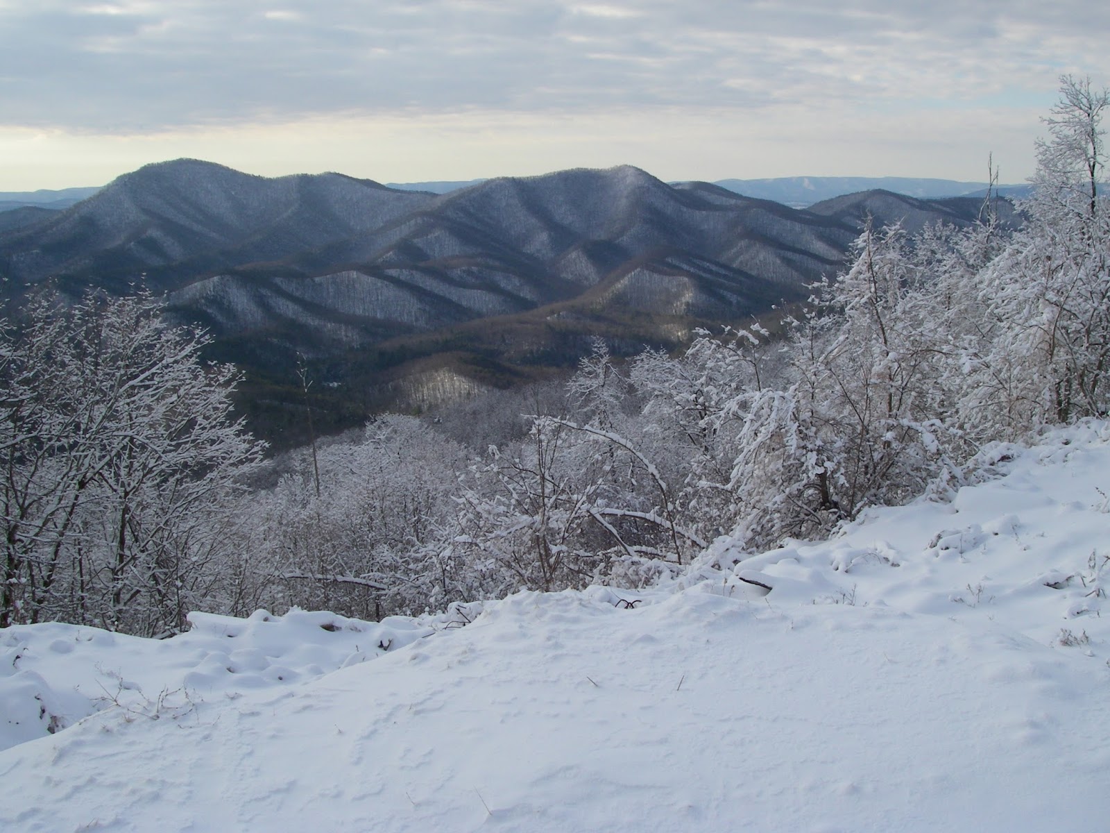
Showing posts with label Virginia. Show all posts

Friday, January 31, 2014

Peak 2310 And Pinnacle - Up High, Down Low


Depending on where you are in the Appalachian Mountains, the “High Peaks” can be those over four, five, or even six thousand feet in elevation. There is also a tendency to sometimes think that these are the premier peaks, and the only ones worth hiking. But despite my own personal guilt of sometimes thinking of the same way, the truth is that in the big scheme of things, even the higher Appalachian Mountains are a pretty lowly bunch. That said, another truth is that the measure of a mountain's worth can be based on many things other than its elevation. Some people hike or climb mountains based on their prominence or their isolation. There is even a dedicated group of people who collect county highpoints, that is the highest point of every county they can visit, no matter how high or low it is. Yet others base their interest on more subjective or aesthetic criteria, like a mountain's appearance, it's difficulty, or perhaps most often, on how good the views from the top are. Some people have yet other reasons. Actually, I like to think I usually give all of these things, and more, their due consideration.


Peak 2310
While I can’t deny that I like climbing peaks that are on a list of the highest or most prominent in a region, the ones I feel most drawn to are those that have great views. If the peak itself is scenic or dramatic in its own appearance, that is another big plus. And if the route up it is steep, challenging, and fun, then that is yet another great appeal. While the higher peaks often do have all of these qualities in spades, they are not exclusive to them by any means, and many lower mountains can also have these same qualities. Such is the case with unnamed Peak 2310 and the nearby and slightly higher Pinnacle.


These two lowly peaks are part of a thirty mile long line of similarly elevated prominences that form the western front of the Blue Ridge from Glasgow to Vesuvius, and average 1,000 feet or more lower than the summits that form the true crest of this section of the range. Despite that, most of them are rather steep, pointy, and rugged. In fact, while these low peaks don’t show up on the more common peakbagging lists, nine of them rank in the overall steepest 100 peaks in the state. Four of them, including Peak 2310 and Pinnacle, are in the top 50. There is no doubt that they are true peaks in their own right, despite the fact that my desk at home in Wytheville where I am writing this is almost identical in elevation to Peak 2310 - which happens to rank as the 945th highest peak in the state. Most also have the distinction of being trail-less, and I would hazard to guess rarely visited - at least by hikers. I certainly haven’t encountered anyone else during my treks in the area. I first visited these two peaks on separate hikes back in early 2012, first doing Pinnacle and Target Hill, then climbing Peak 2310 and Three Sisters Knobs a couple months later. Each of the two this post focuses on had the distinction of being the best of the two peaks I climbed on each trip, and I knew I wanted to come back again sometime, hopefully with a friend to show them off to. My buddy +David Socky  was up to the challenge, as usual, and we picked a nice, clear Winter day to meet up.


Pinnacle

Sticking with the route I used the first time, we headed up a gated Forest Service road that leads into the Davidson Run drainage, then veered off of it onto the western ridge. This climbs east, then northeast to the top. This is entirely off-trail, and while it is a bit brushy in spots and there are a few briers, overall the bushwhacking is not too bad. The need to curse is only sporadic. Along the way on the uppermost several hundred vertical feet, however, there are a number of rock outcrops with fun scrambles and great views ranging from south to west to northwest. Some of the peaks visible include Three Sisters Knobs and Apple Orchard Mountain in the contiguous Blue Ridge. Most of the views, however, are of peaks across the Great Valley in the Alleghenies, like Short Hills, the impressive cone of Sugarloaf Mountain, Big House and Little House Mountains, Big Butt, and Jump Mountain. Once on top of this lowly 2,310’ peak, there is also a view of more Blue Ridge peaks, including Pinnacle, Bluff Mountain, and the 4,000 Footer of Rocky Mountain. All in all, it is surprisingly fun and impressive for a mountain whose elevation is slightly lower than a significant portion of the town I live in and about the same as my apartment. We went down the more northerly of the two western ridges. It doesn’t have any real views but is easier going and makes for a nice loop.


Dave scrambling up the west ridge of Peak 2310
The scrambling continues
Big Butt and Jump Mountain from Peak 2310, awesome hikes themselves.

Once we got back to the car, before heading for Pinnacle, we crossed the road and did a fairly quick and easy hike up Brady Hill. This was uneventful other than Dave getting rather bloodied and cut up by some wicked thorns near the very beginning. There weren’t any views from this 1,529’ mountain, but it did have some nice open woods and was a new ranked peak for me - Number 1,446 out of 1,615 total peaks in the Virginia elevation rankings to be exact. Neither the Virginia 1ers, nor the Virginia Highest 1,500 are lists I aspire to make much progress on…

We drove another mile-and-a-half up the road to the start of the old, now abandoned Belle Cove Trail to begin the trek up Pinnacle. The information I have been able to find indicates that this trail was devastated as a result of a week long period of sustained and heavy rain that occurred over a large area the central and northern Blue Ridge June of 1995 and caused a lot of flooding and a considerable number of landslides in the mountains. It never was reopened, but the lower end still makes a good approach trail for climbing Pinnacle. I assume that one of the neatest features of Pinnacle is a direct result of that same weather system nearly twenty years ago. About a mile up the trail is a tiny tributary of Belle Cove Branch that drains part of Pinnacle’s west side. It is very narrow and confined in a steep-sided ravine, but if one follows it upstream for about 250 yards, it leads to the base of a small but genuine Adirondack-like slide on the north side of Pinnacle’s major southwest ridge. The size of the small pine trees now growing back would seem to agree about the age of the slide. Here a 250 yard long and 50-100 feet wide section of the mountain shed its surface down to the underlying bedrock, taking the trees and soil away. I was very excited to find this open slide on my bushwhack up Pinnacle in January of 2012. It made a great climb with awesome views that got better and better the higher I got, and made me feel like I was in the Adirondacks. The slope is moderately steep, but in dry conditions has good footing, and there is no bushwhacking since it is mostly open - at least for a few more years anyway - being mostly bare rock and loose cobbles. Unfortunately, it wasn’t quite as much fun when Dave and I did it. There was just enough snow and ice on the slide to make it treacherous, but yet not enough to justify breaking out our microspikes. The result was that we clung to its edges, partly in the trees and shrubs. But it only took a step or two out into the open to again enjoy the great views to the northwest, where House Mountain in particular is very prominent. Too soon, the slide narrows and ends, and it is very obvious the exact spot the slide started, there even being a small headwall of sorts.

This little gorge and unnamed tributary of Belle Cove Creek leads to a great slide on the southwest ridge of Pinnacle.
I was excited to find this open slide on my first bushwhack up Pinnacle. It made a great climb with awesome views that got better and better the higher I got and made me feel like I was in the Adirondacks
On this visit, there was just enough snow and ice on the slide to make it a little treacherous, but not enough to justify putting on our microspikes - so we ended up hugging the edge for better footing.
Little House Mountain in front of Big House Mountain, seen from the slide on Pinnacle.
From this point, we continued southward and perpendicular a short distance farther until we hit the crest of the peaks main southwest ridge. From here on to the top, there are a number of outcrops on the rocky ridge that provide some easy but fun scrambling and more expansive views than the slide offers. One of the first is a great view south of the conical form of Peak 2310. Continuing higher, from various points along the way, there are views in most directions that take in such sights as Apple Orchard Mountain, Purgatory Mountain, The Knob, Short Hills, a very impressive looking Sugarloaf Mountain,Target Hill, Silas Knob, and Big Rocky Row among them. All in all, it is as rewarding and challenging a climb as almost any of Virginia’s 4,000 Footers. Just like Peak 2310, and unlike more than a few of the 4,000 Footers, there is no doubt where the exact summit of this pointy peak lies. We touched a foot to it, enjoyed some more views while we had a snack, then headed down the north ridge to a yet a couple more viewpoints. At the last of these, and around the 2,000 foot elevation, we deviated from my previous descent route when I was also going after Target Hill, and headed down a minor ridge in a northwesterly, then westerly direction to a saddle crossed by an old woods road a thousand feet lower. From here it was a mostly easy walk back to our starting point and the end of another great adventure in the mountains of Virginia.

Scrambling on Pinnacle
An overlook near the top of Pinnacle
To see the topo map larger on this site, click on the map. Or click here to see a larger interactive version on Gmap4.
Elevation profile for Peak 2310 and Brady Hill

Elevation profile for Pinnacle

Hike stats:
Peak 2310 and Brady Hill - 4.85 miles, 2,220' cumulative elevation gain
Pinnacle - 4 miles, 1,701' cumulative elevation gain

More pics:

Resources:

Trailhead coordinates for Peak 2310:  37.6619, -79.4204

Trailhead coordinates for Pinnacle: 37.6799, -79.4067

created with Chrome OS, Android, and various webapps

Saturday, January 4, 2014

Griffith Knob and Peak 3681 - Unknown And Unnamed Isn't A Bad Thing


Griffith Knob and Peak 3681
All of the best hikes are not documented. Sometimes I think about writing a small booklet titled “The Best Unknown Hikes of Southwest Virginia”, or something similar to that, and having a listing and descriptions of local favorites, close to home but worthwhile outings, and obscure but great locales that may be either on or off trail. They might be long or short, difficult or easy, but the one thing most would have in common is that while some may be well known locally, they have been rarely or perhaps even never documented on anything other than a limited scale. Regionally well known hikes like Mount Rogers and The Cascades would not be included in this category unless they were incidental to a lesser known nearby spot, though it might be somewhat subjective on my part as to what is well known and what is not - and what is worthwhile. Most might not make it onto a list of the best hikes in the Southern Appalachians (though some could), but all would be worthwhile and of interest to someone in the area who didn’t want to drive several hours to a good place to hike, or didn’t want to be gone all day. Most of the hikes would be on public land, but if I knew that a landowner welcomed hikers, then some destinations could be on private property. Whether or not such a book ever comes to fruition, it occurred to me that I can pursue that idea in this blog from time to time. One such hike would be Peak 3681 and 3,782’ Griffith Knob in Wythe County, a half day (or less) hike little more than 20 minutes away from my home in Wytheville.

These two peaks are on Brushy Mountain, located in the northern part of the county only a few minutes from U.S. Highway 52, and are within Jefferson National Forest. Respectively, they are the seventh and fifth highest peaks in the county, and the higher Griffith Knob is also the most prominent peak in Wythe County. It should be pointed out that part of this hike is quite steep and on very faint trails, and part of it is completely off-trail, albeit in relatively open woods. As such, it is probably best done in cooler and less vegetated months. The views will also be better then. It is also easy to do only Peak 3681 for a round trip of only around two miles, though because of the route, there is little reason to not include the short side trip to the top of this one even if the primary goal is only Griffith Knob.

Mount Rogers and Whitetop from Peak 3681.
The hike begins at an unmarked pullout on FS 221 only a couple miles from Deer Trail Park. There is an obvious but unmarked path at first, perhaps made by hunters, that starts at the upper end of the parking area, and immediately begins a moderately steep 700’ climb up one of the northeastern ridges of Peak 3681 to the main crest between the two peaks but high on the shoulder of Peak 3681. The path becomes increasingly difficult to see as you climb higher, something to be well aware of for the return trip when it will be surprisingly easy to veer off onto the wrong ridge, but as long as you stay on the crest of this spur ridge going up, you will get to the right spot, hitting the main crest at about the 3,500’ elevation. Take special care to remember this exact spot. From here, turn west and continue upwards less steeply for another 3/10 mile to the top of Peak 3681. There are no wide open views here, but there are at least three spots with limited but pleasant views in different directions. From very nearly right on the summit, there is an outlook to the northwest of Walker Mountain, and peeking above its spine are the more distant and higher peaks of 4,409’ Chestnut Knob and 4,710’ Balsam Beartown, both on the rim of Burkes Garden. A few yards down the northern ridge is an outlook to the east that takes in the valley of Stony Creek between Big Walker and Little Walker Mountains. To wrap things up, one can wander perhaps 50 yards down the southern ridge and find a couple of decent sized openings in the canopy that allow some nice views of Mount Rogers and Whitetop, as well as a swath of the Iron Mountains. Again, none of these views are wide open, and they will be better when the leaves are off the trees - but they are all pretty pleasant scenes and ones that I find quite appealing.

Admiring the view of Stony Fork Valley and Little Walker Mountain from Griffith Knob.

After taking in the views, simply return back to the spot where the crest of the ridge was attained on the first leg of the hike - and again, remember it well, as it is easy to miss. At this point, you should head downhill about 1/10 mile along the southeastern ridge, losing a couple hundred feet of elevation, then regaining it to the top of the next unnamed knob at 3,640'. At this point, continue eastward on an old woods road, losing only about 50' before making a final 200' climb up Griffith Knob. It should be mentioned that the rest of the route is on the boundary between National Forest and private property, so don't please don't wander off the ridge crest to the south or east. There is no view from the top, but this is the most prominent peak in Wythe County and knowing that gives a certain satisfaction of its own if one cares about such things. Incidentally, when viewed from several miles away to the east, especially when the leaves are off and there is a bit of snow on the ground, the broad top surrounded by steep slopes and horizontal rock banding give this mountain a very “Catskillian” look that is quite impressive.

The conspicuous peak of Floyd County's Buffalo Mountain seen from Griffith Knob.


One might as well have the views too though. About ¼ mile down the north ridge, where it begins to narrow and then drop off more abruptly, there is a small clifftop opening a few yards off to the right. This is easily the best view of the hike, with an open arc of the landscape to the east and southeast. Little Walker Mountain, Queens Knob, and Sand Mountain are all in plain view and the solitary volcano-like and symmetrical form of Floyd County's Buffalo Mountain is very conspicuous to the southeast on a clear day, despite its being 44 miles away. This is a great spot to hang out for a while and enjoy what will almost certainly be complete solitude. On the return trip, hope you were paying enough attention to your route to avoid going down the wrong ridge anywhere, something that would be very easy to do in at least four different areas. A recorded track on a GPS could be much appreciated now, but it is still better if you made a mental note of key direction changes on your way here.
This hike is not going to attract crowds of people from all over the Southeast, or even the state. However, if you live within an hour or so, and are looking for something new and different, but not without some rewards, this is one of those little known hikes that can fit the bill. There are many more...


To see the topo map larger on this site, click on the map. Or click here to see it on CalTopo.


Elevation profile for this hike.

Hike stats: 4.2 miles, 1,950' cumulative elevation gain

More pics:

Resources:

Trailhead coordinates: 37.0120, -81.2283


created with Chrome OS

Sunday, December 1, 2013

Comers Rock - Earning Your Views


There are often days when I am not especially motivated to go hiking, but feel like I should get out in the woods for a few hours anyway. These same days, I usually don't want to be gone all day, nor do I want to drive very far - generally no farther than thirty minutes away. While I’m lucky enough that there are a few very nice destinations that close to home, that distance nevertheless really limits the choices, and while a lot of the hikes that close are pleasant enough, most are little more than a walk in the woods. There just aren't very many spectacular destinations really close by. Some may be nice enough otherwise, but lack appeal because there is also a road to or near the final destination. That usually takes away any feeling of remoteness out wildness, and usually makes one question why they are hiking up, when they may well encounter hordes of people who drove up. And while I myself am not averse to driving up certain peaks on occasion, it’s rarely as rewarding as a good hike to the same place.

Such is the case with Comers Rock. One can drive to within a hundred yards or so of the top, a fact that often makes me discount it as a "serious" hiking goal. But I always forget just how good views actually are from up there on a clear day, and they are even better when you earn them by hiking up. And despite the proximity of a road, there are no"hordes". Besides, it's a pleasant hike anyway, if the chosen route is through the Little Dry Run Wilderness located to the north of the mountain. For the best part of the first three miles, this trail follows the namesake creek of the Wilderness (a rather grandiose term for this little 2,858 acre parcel), a tiny little stream with gorgeous hemlock lined banks, and small pools and undercut banks that harbor native brook trout, some of the prettiest freshwater fish there are. Finding their haunts was one of the original motivations for my interest in hiking. Though I don't fish for brookies any more, I still love visiting the beautiful places they live.


Tommy Bell along Little Dry Run. While not from this particular hike, it shows how pretty the area is.
The hike starts with an unbridged crossing of Dry Run. If the creek is low enough to rockhop here, then the rest of the hike is probably not an issue. If it’s really high, you might want to come back another day. The trail follows Dry Run upstream a very short distance, then sidehills back to the North and West to reach Little Dry Run. It crosses this smaller stream numerous times, and is a bit vague in a few spots, but as long as the creek is near, so is the trail until one reaches the uppermost headwaters - and if one avoids the trailless northern tributary at the 1.4 mile mark. On another note, it was near this spot a few years ago that I turned off the trail to climb Peak 3,300, the last summit I needed to have climbed all of Wythe County's 43 ranked peaks. That adds another element to my fondness of this area. As the stream dwindles to a trickle, the trail steepens and climbs to a broad saddle to intersect the Virginia Highlands Trail. This makes an appealing return route by following it back to the highway, but the way to the top avoids it and continues straight across, onward and upward from this divide that separates Little Dry Run from Jones Creek. While it is never really steep, the remaining mile-and-a-half is decidedly uphill. Very close to the end, after all one’s work to get here, the trail disappointingly deposits one onto the gravel Forest Service road going to the same place. However, after only a hundred yards, it ends and a set of rustic stone stairs lead the remaining steps.  At least the final 150 yards is foot travel only, so there is some solace in knowing that even if you share the summit with other people, you don’t have to share it with their vehicles as well. And you know they didn’t see the pretty places you were privileged to see on the way up. As it turned out on this visit, I had the top all to myself the whole time I was here.

Brumley Mountain, Middle Knob, and Beartown on the horizon.
The summit has a couple of attributes of interest to only to peakbaggers. At 4,100’ in elevation, it is one of Virginia’s 97 ranked Four-Thousand Footers, coming in as the 62nd highest peak in the state. As it is the only peak over 4,000’ in Wythe County, is also the county highpoint for my home county. For everyone else, there are the views. The top has a few rock outcroppings, as well as a deteriorating viewing platform. Even though the railings are falling off and trees have been allowed to block the view to the West, this low platform offers quite a dramatic prospect. Starting in the Northwest and turning clockwise all the way back to the Southwest, the phalanx of mountains marching around the horizon includes a distant Brumley Mountain, Middle Knob, mighty Beartown Mountain, and White Rock on the Clinch Mountain massif. Closer in is Glade Mountain and its associated ridges as well as the sixty mile long sweep of Walker Mountain. Beyond it, to the North, are cliffbound Knob Mountain and Wynne Peak, as well as Chestnut Ridge, spruce-clad Balsam Beartown (sixth highest in Virginia, and the highest that isn’t part of the Mount Rogers massif), Garden Mountain, and East River Mountain. Most of Wythe County is in sight, and notable peaks include its most prominent peak of Griffith Knob, pointy Queens Knob, Cove Mountain, and its most isolated peak of Sand Mountain and attendant High Rocks, Lick Mountain, Stuart Mountain, Swecker Mountain, and Henley Mountain. This latter range separates the Cripple Creek and Reed Creek Valleys. Draper Mountain, Peak Knob, and High Knoll are next, while much farther to the Northeast are the high peaks of Sugar Run Mountain and Bald Knob, the latter over 50 miles away and Virginia’s most isolated peak. I can’t honestly say I have ever really looked for it, or if I have even been here on a clear enough day, but some research shows me that it should also be possible, at a bearing of 61°, and about halfway between Peak Knob and High Knoll, to see Apple Orchard Mountain from here as well. This is Virginia’s most prominent peak, and is nearly 110 miles away. If indeed it is ever visible, this would probably be one of the longest line of sight views possible in Virginia, if not the entire Southeast. It was clear on this most recent visit, but definitely not that clear. Much of the Eastern end of the Iron Mountains, of which Comers Rock itself is part of, extend as far as the New River. Things flatten out a bit on the rolling Blue Ridge Plateau to the Southeast, but a couple notable exceptions jutting up are Floyd County’s and Carroll County’s respective highpoints of Buffalo Mountain and Fisher Peak. To the south rise the considerably higher Grayson County peaks of Point Lookout and Buck Mountain, the eleventh and eighth highest mountains in the state. While not exactly in your face, the most dramatic view is probably to the Southwest. This would be the compact cluster of North Carolina mountains known as the Amphibolites. Among the rugged and spectacular peaks in view are Mount Jefferson, Phoenix Mountain, Bluff Mountain, Elk Knob, ragged Three Top Mountain, Snake Mountain, and the aptly named The Peak. Farther away are the glorious balds of the Roan Highlands. Quite an amazing collection of peaks really, but still not quite everything. By moving off the platform and onto the rocks nearby, one can look to the right of nearby Bald Rock Ridge and get a pretty good look at one of my most special places - the Grayson Highlands. Rising above First, Second, and Third Peaks are Virginia’s highest terrain. Big Pinnacle, Wilburn Ridge, and Mount Rogers are all in sight, and beckon as they always do. And by walking up, you earned the views, and can appreciate them even more. If you come in the Winter after a big snow, it might not even be possible for anyone to drive up even if they wanted to.

The eastern Iron Mountains. Floyd County's Buffalo Mountain is faintly visible near the center of the horizon.
The rugged Amphibolites of North Carolina, including Phoenix Mountain, Bluff Mountain, Elk Knob, Three Top, Snake Mountain, and The Peak.
Virginia's highest and most alluring terrain - looking towards Big Pinnacle, Wilburn Ridge, and Mount Rogers.

To see the topo map for this hike larger on this site, click on the image or click here to see it on CalTopo.


Elevation profile for this hike.

Hike stats: 9.9 miles, 2,000 cumulative elevation gain


Pictures from other visits to Comers Rock

Resources:

Trailhead Coordinates:  36.78855, -81.18327 
(trail begins across road from parking area, on West side of road)

Saturday, November 2, 2013

Bluff Mountain And Hellgate Ridge - Neglect and Rediscovery


Sometimes you realize that you shouldn't have waited so long to do a hike again. Such was my case with Bluff Mountain. I had hiked the Appalachian Trail up this mountain once before, way back in 1994. I don't really remember what I thought of it then. Maybe it was hazy, or maybe I just didn't feel like writing, because my journal from that day only makes mention that I was there. But I still knew it had a view and so it seemed like it was time to rediscover it. I've been very close to it again quite a few times during the intervening years, on a number of hikes to Rocky Row, and also to several other nearby peaks like Pinnacle.

It is a very conspicuous peak from a number of more distant viewpoints throughout the region. One reason for that is that despite its modest elevation of only 3,372', it is the most prominent peak along a 26 mile stretch of the Blue Ridge and dead center between the even more prominent, but less distinctive peaks of Apple Orchard Mountain and Rocky Mountain. It is one of only 106 mountains in Virginia to have over 1,000 feet of prominence and rises to a fairly small summit. These qualities make it stand to reason that it was once a firetower peak, and should command an extensive view. It was time to refresh my memory...

My approach the first time had been on the Appalachian Trail, but several explorations of other peaks in this area had brought a potentially interesting, and more challenging option to my attention. Assuming the Forest Service map was correct and there was public access at the start, the topo showed a pipeline and attendant service road going up Bennetts Run, then making a near beeline most of the way for the summit from the northwest. Satellite imagery seemed to confirm the same and so a plan was made. My frequent hiking companion +David was free, and up for a good hike, so off we went to explore.


Looking back at Pinnacle.
We found the gated Forest Service road and began our hike at an elevation of only 900', leaving a respectable climb to the top. The route was a bit confusing at the beginning as we skirted around a large car junkyard on private property, then tried to follow a more obscure woods road to the pipeline. We lost it in brush and briars and had to just cut through the woods to find the pipeline, only to discover it too was pretty brushy, with waist high greenery still not quite knocked down by the return of cold weather. This would not be fun in the green months but nevertheless led us up Bennetts Run, and between the peaks of Pinnacle and Target Hill (both worthy destinations themselves) to the point where the small stream split into its North and South Forks. The hiking became much more interesting at this point, as the pipeline abandoned the overgrown drainage and climbed steeply straight up the fall line of the Northwest Ridge of Bluff Mountain. The route became a rocky treadway, a narrow road really, and climbed up through open woods with some occasional views behind us of Pinnacle and Target Hill, and through the “V” they create, which allowed us to see part of the fog-laden Maury River Valley and the ridges of the Alleghenies beyond. The grade eased briefly in a couple areas, but overall it remained a fine, steep ridge that was relatively narrow and scenic. I liked it a lot!


Rocky Mountain and No Business Mountain.
Finally, at about the 2,500’ level, the pipeline veers abruptly south to drop down a few hundred feet in elevation, then climb again to the shallow gap separating Bluff Mountain and Hellgate Ridge. The ridge we were on looked more appealing than ever now, and we certainly didn’t see any reason to lose elevation, so we opted to head off-trail and continue on our current course to the top, which was now only ¾ of a mile away, albeit still over a 800 feet higher. There was a bit of scrambling, some limited views, and a bit of rhodo-whacking to round things out, but all in all it was a fine little climb. A short distance from the top, we hit the old fire tower access road and followed it the remainder of the way.


The panorama West and North from Bluff Mountain looks across the Great Valley to Big Butt, Jump Mountain, and Great North Mountain in the Alleghenies as well as toward such Blue Ridge summits as Whites Peak and Adams Peak.
Though the lookout tower that would have allowed a 360° panorama is sadly now long gone, the semi-open summit did not disappoint. Between the hardwoods and a curious handful of red spruce - usually found considerably higher or farther North, there was a great view to the south of High Peak and No Business Mountains, with the vast flattening of the Piedmont extending beyond to the limits of the horizon. But the real reward was the sweeping view of mountainous country to the North and Northeast. Close at hand were many of the low, but steep, rugged, and pointy peaks that form the western front of the Central Blue Ridge in Virginia. Among these were Elephant Mountain, Garnet Peak, Silver Peak, Whites Peak, and also Adams Peak and McClung Mountain - the last two personal favorites. To the left of all those peaks was a long swath of the Great Valley, with Buena Vista and Lexington both in sight. Beyond the valley rose the long wall of the Alleghenies, with House Mountain, Big Butt, Jump Mountain, and Elliot Knob all plainly in view along with many others. I have no intention of allowing twenty years to pass again before a third visit.

A neat pinnacle on Hellgate Ridge.
Rather than backtracking on the return hike, we followed the Appalachian Trail south a short distance, then headed off-trail again to traverse Hellgate Ridge. This was rather thick in places, but we did find a neat pinnacle on the ridgeline, as well as a small clifftop overlook with views of Silas Knob and Big Rocky Row. We also found a limited, but great view of conical Peak 2310 and impressive looking Sugarloaf Mountain.

We should have continued along the ridgeline to the top of Pinnacle for more great views and another summit for the day, but instead we dropped back down to Bennetts Run from the low spot on the ridge. This required some very steep and tedious sidehilling, and dealing with a lot of fallen trees near the creek before climbing back uphill again anyway to regain the pipeline trail. From there is was easy walking on now familiar terrain, and we found and successfully followed the faint road we had lost near the beginning of the hike. It will serve me well in the not too distant future when I do this hike again. I’m not going to neglect this great peak again now that I have rediscovered its treasures.

A minor viewpoint on Hellgate Ridge, looking toward Silas Knob and Big Rocky Row.


Route of the Bluff Mountain hike. To see a larger map click here.
Note: There seems to be a problem with the default map view I have selected not showing properly. Please select the map you prefer from the drop-down menu in the upper right hand corner of the map.

Add caption
Hike stats: 9.25 miles, 3,280' cumulative elevation gain

Pictures from this hike.

Resources:
gpx, kmz, topos for this hike

Trailhead coordinates: 37.68971, -079.39118
Google Map for trailhead


Thursday, July 18, 2013

Outdoors Based Education At Muddy Squirrel, LLC

I just wanted to take a few minutes to promote what sounds like a great new Outdoor Education School based in Troutville, Virginia. A couple weeks ago, my conservationist friend Liza Field told me about a friend of hers who is, or rather was until just recently, a teacher in Fincastle as well as being a fellow hiker and lover of the outdoors.

In addition to their normal studies, Tim Miller was regularly taking his kids outdoors and teaching them about the natural environment as well. Over time, he became frustrated by the SOL test score driven system that is predominant in the schools now and decided to branch out in another direction. Along with his business partner and equally qualified co-instructor Lisa Moyer,  Tim and she have recently started their own outdoor education program in the mountains of Virginia.

While wanting to help teach kids the knowledge they need to do well on standardized tests, they also want to teach them practical skills, self-reliance (and teamwork), and how to think for themselves, as well as learn how they fit into their communities and the larger world, and what their impacts on that world are - using the challenges and setting of the outdoors as a classroom.

If you have children who could benefit from this type of learning, and any could, please take a look at Tim’s website here, and particularly at the Mission Statement, Schedule, and Courses. They can be contacted through the website or at muddysquirrelinfo@gmail.com


Friday, April 26, 2013

Traversing The Mount Rogers High Country


Wow, I can’t believe how far behind I’ve allowed myself to get on this blog. I’ve got a sizeable backlog of hikes to catch up on, but at least the heat and rain have sapped my motivation lately and caused the list to stall, rather than keep growing. On the other hand, the hot weather of Summer makes this entry even more timely, because it is a place to escape the worst of the heat.

Since starting this blog, it was only a matter of time until I had a chance to get back up into the Mount Rogers High Country. Though it is incredibly difficult to pick one place over all others, this is quite possibly my favorite area in all of the Southern Appalachians. That is really saying a lot! There are many reasons for that, but for the most part I can narrow it down to a few key things. It was one of the first really awesome places I went when I first started hiking, which helped get me hooked. The windswept open grassy balds, huge rock outcrops, and stands of dark and damp boreal forest are incredibly scenic. The latter is directly related to the 5,500’ plus elevations here, far higher and cooler  than anything else in Virginia, and gives the whole area a distinct climate with wild weather that decidedly subalpine, and much like what one encounters in the mountains of the Northeast, often cold, windy, and concealed in the clouds. I wasn’t there, but snow, sleet, and freezing rain all occurred on June 30, 1979! It is another world, quite unlike anywhere else in the state, and I have seen it referred to in print as “a little piece of Montana set on the rooftop of Virginia”, or something along those lines. I don’t know specifically what part of the Big Sky state they had in mind, but I can say from personal experience that if it was possible to set Wilburn Ridge down in the western foothills of the Wind River Range, near the town of Pinedale in Wyoming, it would blend right in. A dense network of trails and abundant, dramatic views are yet another draw for me. Then there are the “wild” ponies, awesome rhododendron displays in June, acres of blueberries in August, frequent and impressive snowfalls and rime accumulations in Winter. Being close to home and readily accessible doesn’t hurt either. All taken together, even though the “High Country” here is certainly not the most dramatic area I have ever been, it is probably more responsible than any other single place for having nourished my love of the mountains, and will always be a special place for me, no matter where I may find myself. Suffice it to say, one blog post is not going to do it justice.


Haw Orchard Mountain (left), Wilburn Ridge, and Mount Rogers (right) seen from Stone Mountain.
The area that I generally refer to as the “High Country” may be a little different from what is “officially” designated as such, but, in my mind, it is all of the terrain above 4,000’ in elevation on the massif that forms Mount Rogers and Whitetop. It does not include any of the terrain above that elevation on the nearby Iron Mountains, which are also part of the Mount Rogers National Recreation Area, but have little else in common to my way of thinking. Narrowing things down even more, a smaller area on the high, open ridges of Stone Mountain, Pine Mountain, Brier Ridge, and Wilburn Ridge that is near or above 5,000 feet is generally referred to as the Crest Zone, and is one of the main attractions to the whole area. This makes up the bulk of the scenic “Big Sky” terrain that these highlands are famous for. Ironically, for the most part, it is not natural. It was heavily logged and subsequently burned in the early 1900’s, and the harsh climate and poor, rocky soil made recovery a slow process. At some stage along the way, it became the scenic wonderland it is now, and the Forest Service acquired it and decided to try and maintain these open qualities with management practices such as controlled burning and grazing. It works for me!

On this particular hike, I met up with my friends +David Socky , +Stephanie Petri , and +Brian Williams . Stephanie had never been here before, so I came up with the idea of a nice, long shuttle hike that would hit most, though not all, of the highlights. I casually suggested that we start at the lower trailhead, hoping no one would think too much about it, and we dropped off one vehicle at the 4,460’ gap of Elk Garden, the high pass between Mount Rogers and Whitetop. Then we dropped down to the 3,600’ trailhead for the Lewis Fork and Cliffside trails. I also sort of neglected to mention that the Cliffside Trail, which we would be going up, is probably the steepest trail for any considerable distance in the High Country, but this also makes it the shortest approach to the Crest Zone from the north, getting one into open country in only about 2 ½ miles. It gets more interesting just shy of the two mile mark, when it steepens considerably, then quickly enters the lower edge of the boreal spruce-fir forest that is one of the defining features of High Country.

Looking up at the higher crags on Wilburn Ridge.

Typical scenery on Wilburn Ridge.
Today was a great day to be up there, a mid-Spring beauty of a day neither too hot or too cold, but just right. It was sunny and clear,  with a cool breeze and decent visibility up on the high ridges. After we topped out at the upper end of the Cliffside Trail, we headed away from Mount Rogers, something Brian dryly pointed out numerous times over the next few miles as we got farther and farther away from it, as it was one of our destinations for the hike. We were out in the open with awesome views of craggy Wilburn Ridge as we followed the Crest Trail to Scales. This was once the site of an old weighing station, now gone, for the cattle that once grazed in the High Country when it was privately owned, and is now a major intersection of trails up here. We joined the Appalachian Trail here and continued through the meadows atop Stone Mountain, where the views of Wilburn Ridge are, if anything, even more austere and impressive - but still not the best. Along this leg of the hike, the rugged little summit of Big Pinnacle on Haw Orchard Mountain is also seen from one of its better perspectives. This is also one of the more exposed areas in the Winter, with little shelter from the wind for a mile or more.

Then we headed back into the woods for a while, dropping down to the tannin-stained headwaters of Wilson Creek, already a decent sized little trout stream at an elevation higher than all but a small handful of Virginia’s highest peaks. Near here we encountered one of the trademark bands of the “wild” ponies that roam the mountains here and help to maintain its open character. There were a couple of young foals with their mothers and Stephanie had an acute case of “cuteness overload”, one of several that occurred over the course of the hike.

Stragglers along the trail.

The trail then begins its climb to the highlight of the hike, making its way through one of the best blueberry picking areas here along the way - though it was months too early for that tasty reward. That happens in August, not April. Soon after crossing Quebec Branch the trail comes out in the open once again, just shy of 5,000 feet above sea level and begins what I consider to be the finest 2 ½ miles of hiking in Virginia, as well as a strong contender for that distinction in the entire Southeast as far as I’m concerned. Others are free to disagree, but I don’t think any would be disappointed if they are here on a good day. This is now mostly open, park-like terrain with huge, rugged outcrops of pink granite (actually rhyolite), and just enough heath and small stands of red spruce and fraser fir to give it a sub-alpine appearance. The trail weaves between the outcrops at this point, but there is ample opportunity to scramble up any of them just for fun, as we did. The summit of this “little piece of Montana” looms another 500 feet above and looks very much unlike typical Southern Appalachian terrain. Even the magnificent Roan Highlands and the similar high country of the Shining Rock Wilderness lack the massive rock outcroppings found here. It is strikingly scenic, and the views only get better as you climb higher on the ridge. Soon, we were beginning to look over the top of 5,100’ Haw Orchard Mountain, the lowest of Virginia’s three ranked  5,000 foot peaks, and see the rugged peaks of North Carolina’s Amphibolite Mountains in the distance, including Three Top, The Peak, Elk Knob, and Snake Mountain among others, with Grandfather Mountain and the Roans visible even farther away. A little higher up, today, as I almost  always do, we left the AT to stay on the rougher Wilburn Ridge Trail. This more spectacular route stays right on the crest of the ridge and goes directly over the next two rocky caps, and is the crème de la crème of the trek. Upon reaching the next rocky cap at about 5,300’ there is a sublime view of Mount Rogers and Brier Ridge, with Whitetop rising up in the distance, while close at hand the apex of the ridge reaches higher still in stark, rocky magnificence. There is a bit of mild scrambling on the trail, but opportunities abound for much more if you like that sort of thing. I do, and we did indulge in making the hike harder (a.k.a. more fun) than is necessary. If the weather is good, as it was today, there is no finer place to take a break and just enjoy some of the best scenery in the state.


C'mon little fella. Photo by Dave Socky
We continued on to the next equally high summit, which is the highest point on Pine Mountain and where Wilburn Ridge ties in to it, the view open to the north to reveal a long swath of Clinch Mountain beyond the closer Iron Mountains and across the Great Valley. This spot also looks down on Rhododendron Gap, the place to visit in early June when the entire area is shades of pink and purple with a floral display of its namesake flowers second only perhaps to the famed Rhododendron Gardens on Roan Mountain. There is another fun scramble route down from here that I have only seen one or two other groups doing before, but is easier than it looks. Naturally, we went that way and dropped down into the gap, which really isn’t much of a gap in the normal sense of the word, though the area immediately to the southwest would qualify as such. This is another major intersection of trails, with at least five ways to go, and can be confusing on a cloudbound day - especially if you have never been here. But it is a wonderful spot to be lost, surrounded by meadows, rhododendron, awesome outcrops, boreal forest, and possibly some wild ponies. Had we turned right at the top of Cliffside, we could have been here hours earlier. I took evil delight in mentioning this, but only jokingly, because had we done so, we would have missed much, including Wilburn Ridge.


High on Wilburn Ridge, looking at Whitetop rising up beyond the meadows of Brier Ridge.

Fun on Wilburn Ridge.

Scrambling and happy! Photo by Dave Socky


Brian and Stephanie atop Wilburn Ridge. photo by Dave Socky

Brian and Stephanie at Rhododendron Gap.

Another enchanting mile-and-a-quarter took us over Thomas Knob and past the A-frame Appalachian Trail shelter that makes for such a great place to spend the night, or just get out of the weather for a while. Just beyond here, we took the ½ mile spur trail that leads to the 5,729’ apex of Virginia, that being Mount Rogers. Not a bad place for Stephanie to claim her very first state highpoint! While there are no views from here, and I do sometimes lament that, the top of what was once known as Balsam Mountain, or Big Balsam Mountain, is still a delightful place, almost neon green with moss and ferns, the former covering almost everything and the latter filling in all the niches, while the smell of Christmas trees permeates the air. This is Virginia’s biggest sky island of boreal forest, and one of the biggest in the Southern Appalachians. It’s also one of the few such places that the balsam wooly aphid hasn’t nearly decimated the lovely little Fraser Firs, as is the case on the heights of the Great Smoky Mountains and the Black Mountains.


Trout Lily
Atop 5,729' Mount Rogers, the very tiptop of Virginia.

The scenic hits don’t end here though. After returning to the AT, there is more easy walking through this Canadian type forest to the delightful grassy saddle on Brier Ridge and its spectacular views of Whitetop, which is Virginia’s number two mountain, and an exceptional hike in its own right - as is this saddle itself if one wanted a shorter hike with a big payoff.

We took the Virginia Highlands Trail from here to Deep Gap, then rejoined the AT there, now back down in the hardwoods and only a couple miles from the end. But there was another treat just ahead. As we started traversing along Elk Garden Ridge, we soon entered the beginning of a long stretch of trail that was bordered on both sides by one of the better displays of trout lilies I have ever seen. As far as the eye could see through the woods, the forest floor was speckled yellow with the drooping blooms of these beautiful little flowers. Then one last open view north and south from the grassy knoll overlooking Elk Garden and we were finally done with one of the finest long walks to be found in these mountains I call home.


Photo by Dave Socky


The route of our traverse. To see a larger map click here.
Note: There seems to be a problem with the default map view I have selected not showing properly. Please select the map you prefer from the drop-down menu in the upper right hand corner of the map.


Hike stats: 18 mile shuttle hike, 3,750' cumulative elevation gain


Map showing most, though not all, of the trail system on the Mount Rogers massif. The color coding shows all of the terrain above 4,000 feet and 5,000 feet. To see a larger version of this map click here. If you zoom out far enough, this map displays ALL of the terrain in the Lower 48 U.S. states that is between 4,000-4,999', 5,000-5,999', 6,000=6,700', and then all of the terrain out West that is higher than 6,700', and therefore higher than anything in the Eastern U.S.

Pictures from this hike.

Pictures from other hikes in the Mount Rogers High Country (There are no duplicate entries, these are all different hikes)
November 2012
August 2012
July 2012
May 2012
May 2012
May 2012
January 2012
December 2011
December 2011
August 2011
July 2011
June 2011
May 2011
February 2011
January 2011
January 2011
September 2010
September 2010
July 2010
June 2010
May 2010
January 2010
November 2009
September 2009
August 2009
August 2009
July 2009
June 2009
June 2009
May 2009
February 2009
September 2008
August 2008
June 2008
April 2008
January 2008
November 2007
August 2007
August 2007
June 2007

Resources:
gpx, kmz, topos for this hike
gpx, kmz, topos - Master Files for majority of trail system
USFS Mount Rogers NRA page
Grayson Highlands State Park site
Friends of Grayson Highlands
Hiking Upward post
Mid-Atlantic Hikes Grayson Highlands Circuit
Mid-Atlantic Hikes Grayson Highlands 2
Mid-Atlantic Hikes Mount Rogers Backpack
Mid-Atlantic Hikes Little Wilson Creek Wilderness


View Larger Map

Cliffside Trailhead coordinates:
36.69217°, 81.51954°

Elk Garden Trailhead coordinates:
36.64627°, 81.58332°

Scan QR code to navigate to trailheads with Google Maps on your smartphone


Cliffside Trailhead


Elk Garden Trailhead